Sites and Monuments Record · Ireland
Megalithic tomb - passage tomb
Farranyharpy, County Sligo, Ireland
The record
- Townland
- Farranyharpy
- County
- Sligo
- Country
- Ireland
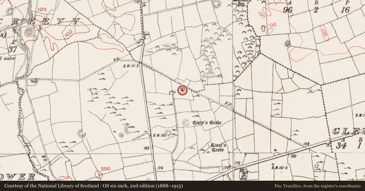
- Latest-edition OS map
- Indicated
- Coordinates
- 54.24532, -8.74636
- SMR number
- SL012-127----
Slide toward Today to fade the historical sheet and see the modern map underneath.
David Rumsey Map Collection, Stanford LibrariesDavid Rumsey Map Collection, Stanford LibrariesDavid Rumsey Map Collection, Stanford LibrariesDavid Rumsey Map Collection, Stanford Libraries
4 historical maps cover this location, the earliest the 1790 map "Composite: Ireland." (David Rumsey Map Collection, Stanford Libraries).
Historical maps covering this location
- 1790 · Composite: Ireland. (David Rumsey Map Collection, Stanford Libraries)
- 1869 · Ireland. (David Rumsey Map Collection, Stanford Libraries)
- 1891 · Ireland 16 (David Rumsey Map Collection, Stanford Libraries)
- 1904 · Sheet 4. (David Rumsey Map Collection, Stanford Libraries)
This record in the National Monuments Service's Historic Environment Viewer ↗
The National Monuments Service's description
Situated in a shallow valley into which a stream feeds from the S and forms a large pool to the SW of the monument. The ground rises to the S and N and there are limited views from the monument to E and W. The remains consist of a sub-circular cairn (c. 17.50m NNE-SSW and c. 21m WNW-ESE; averaging between 0.7m and 1m high) which is delimted by a kerb of boulders, seventeen of which appear to be in situ with many others displaced around the perimeter. The kerb is absent along the NW side and there is a gap in it at the E. The interior is composed of small stones which are covered with a thin layer of soil and vegetation. A raised bank-like feature runs N-S tangential to the cairn on its W side and incorporates a number of the kerb-stones. It expands at each end into a mound-like terminal: that on the S appears as an extension of the cairn. The precise nature of this feature is unclear as is its relationship to the cairn. The remains have clear affinities with the boulder-circle monuments within the Carrowmore passage-tomb cemetery and interpretation as a possible example of this class would not be inconsistent with the present evidence. This, however, is purely tentative and a proper elucidation of the monument must await further investigation. (Timoney 2015)
Compiled by: Paul Walsh
Date of revised upload: 3 September 2014
References
Timoney, M.A. 2015 A Carrowmore-type passage tomb at Farranyharpy, Skreen, County Sligo. Sligo field club journal, 1,32-4.
Nearby in the register
- Enclosureunder 1 mi
- House - indeterminate dateunder 1 mi
- Ringfort - rathunder 1 mi
- Field systemunder 1 mi
Other entries of the same register within about three miles of this one, by straight line.