Sites and Monuments Record · Ireland
Burnt mound
Ardnaglass Lower, County Sligo, Ireland
The record
- Townland
- Ardnaglass Lower
- County
- Sligo
- Country
- Ireland
- First-edition OS map
- Not indicated
- Latest-edition OS map
- Not indicated
- Coordinates
- 54.38746, -8.50930
- SMR number
- SL005-200----
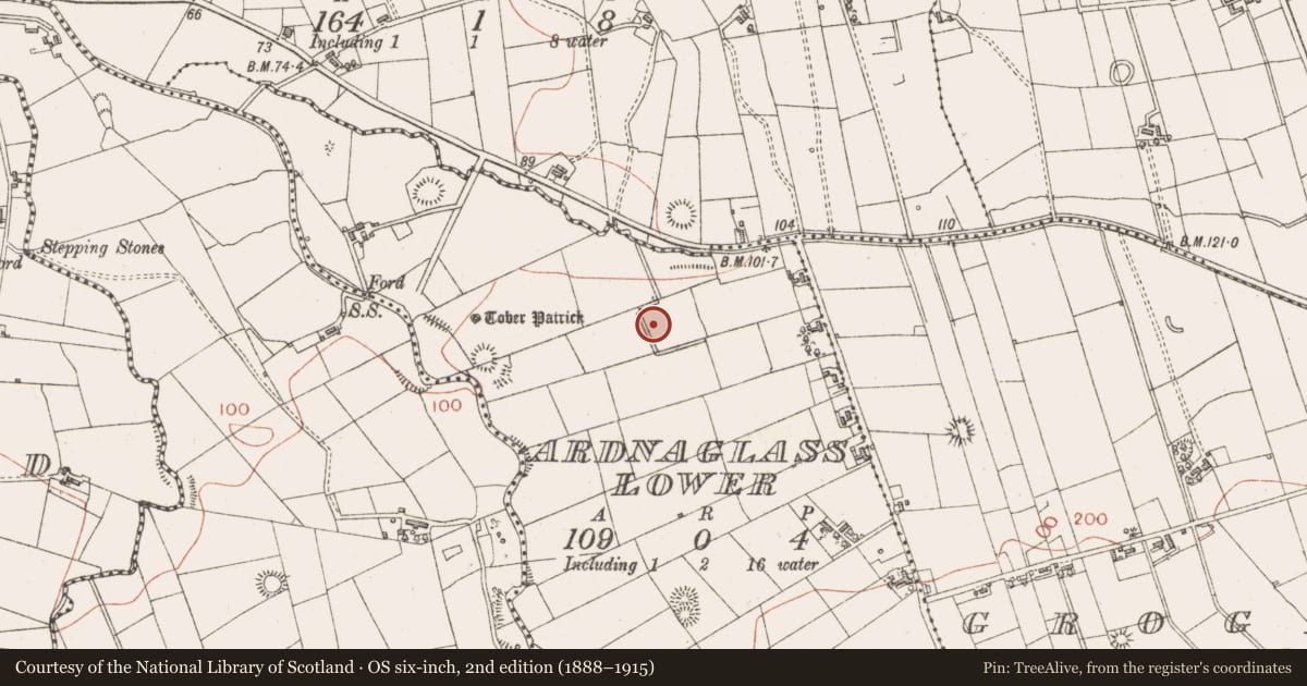
Slide toward Today to fade the historical sheet and see the modern map underneath.
David Rumsey Map Collection, Stanford LibrariesDavid Rumsey Map Collection, Stanford LibrariesDavid Rumsey Map Collection, Stanford LibrariesDavid Rumsey Map Collection, Stanford Libraries
4 historical maps cover this location, the earliest the 1869 map "Ireland." (David Rumsey Map Collection, Stanford Libraries).
Historical maps covering this location
- 1869 · Ireland. (David Rumsey Map Collection, Stanford Libraries)
- 1891 · Ireland 16 (David Rumsey Map Collection, Stanford Libraries)
- 1904 · Sheet 4. (David Rumsey Map Collection, Stanford Libraries)
- 1922 · Ireland - northern section. (David Rumsey Map Collection, Stanford Libraries)
This record in the National Monuments Service's Historic Environment Viewer ↗
The National Monuments Service's description
In the NW corner of a pasture field, located in damp, level rush-grown ground, bordered to E by a low natural rise.
This burnt mound, probably a levelled fulacht fia, is not visible at ground surface level, but is exposed in section in two intersecting field field drains. A dense layer (L 15m; D 0.23-0.3m) of burnt stones in black, charcoal-rich soil is exposed in section in both the E and W sides of a roughly N−S field drain (Wth 1.2m at top, 0.6m base; D 0.4-0.5m), which cuts through the wet NW corner of the field. The burnt layer is directly overlain by topsoil/sod (D 0.15-0.2m), and overlies a peat layer. The drain intersects at its N end with an E−W field drain on the N boundary of the field. The burnt stone layer is also visible in the E−W drain, extending to E for c. 5m from the point of intersection with the N−S drain.
Attached image: SL005-200----_01.JPG Burnt stone visible in drain section, viewed from SE.
Compiled by: Jane O'Shaughnessy
Date of upload: 9 October 2020
Nearby in the register
- Ringfort - rathunder 1 mi
- Children's burial groundunder 1 mi
- Ringfort - rathunder 1 mi
- Ritual site - holy wellunder 1 mi
Other entries of the same register within about three miles of this one, by straight line.