Sites and Monuments Record · Ireland
Hut site
Grange, County Sligo, Ireland
The record
- Townland
- Grange
- County
- Sligo
- Country
- Ireland
- Latest-edition OS map
- Not indicated
- Coordinates
- 54.39732, -8.52641
- SMR number
- SL005-033003-
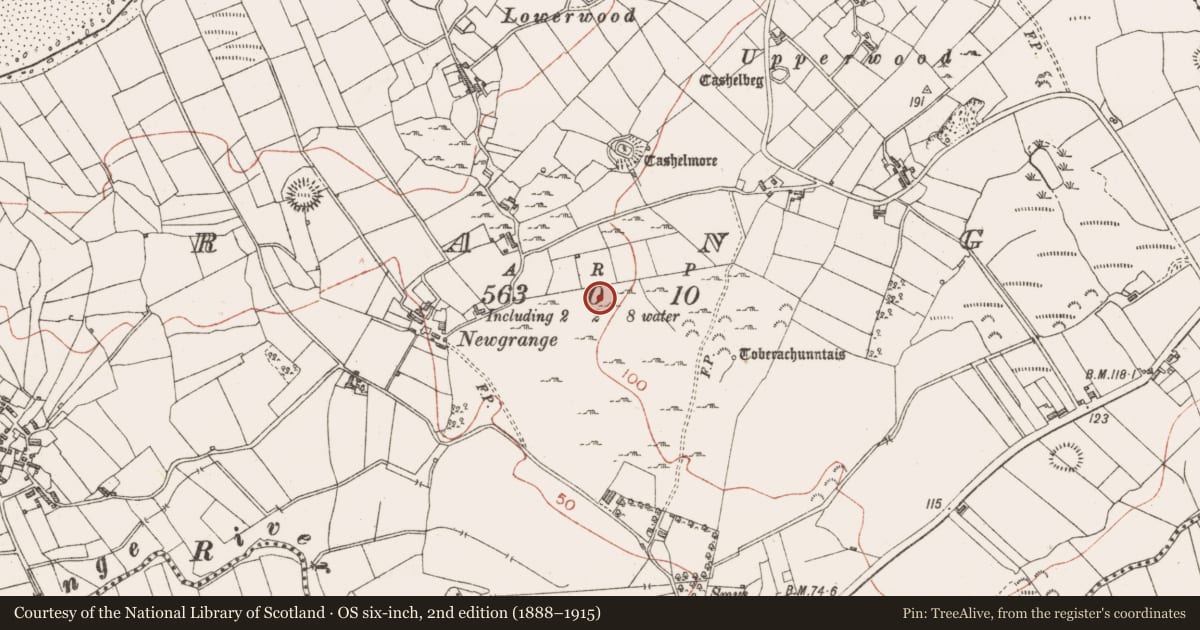
Slide toward Today to fade the historical sheet and see the modern map underneath.
David Rumsey Map Collection, Stanford LibrariesDavid Rumsey Map Collection, Stanford LibrariesDavid Rumsey Map Collection, Stanford LibrariesDavid Rumsey Map Collection, Stanford Libraries
4 historical maps cover this location, the earliest the 1869 map "Ireland." (David Rumsey Map Collection, Stanford Libraries).
Historical maps covering this location
- 1869 · Ireland. (David Rumsey Map Collection, Stanford Libraries)
- 1891 · Ireland 16 (David Rumsey Map Collection, Stanford Libraries)
- 1904 · Sheet 4. (David Rumsey Map Collection, Stanford Libraries)
- 1922 · Ireland - northern section. (David Rumsey Map Collection, Stanford Libraries)
This record in the National Monuments Service's Historic Environment Viewer ↗
The National Monuments Service's description
A group of four hut sites (SL005-033002-, SL005-033003-, SL005-033005-, SL005-033006-) can be distinguished in the N portion of the area. The hut sites are located to the N of a curving relict field boundary in a semi-circular area (area c. 2 acres) of low rocky pasture at the base of the hillock that lies to the E. The hut sites are clearly in a group and enclosed within the semi-circular area distinct from the remainder of the area. The ground here is rocky, undulates irregularly with a slight W-facing slope. Views are excellent inland SW - W, excellent toward the sea W - N and poor to higher ground N - SW.
This hut site is located c. 20m to the E of hut site SL005-03301- and c. 20m to the NW of SL005-03305-. It consists of a rectangular area (4.55m E-W; 1.65m N-S) defined by an earth and stone bank (Wth 1.7m; H 0.3m). The bank encloses the site W - NE and SE - SW and is absent elsewhere. The original entrance is not recognisable. The interior is undulates gently, sloping slightly facing N and is clear of overgrowth. The area around the hut undulates irregularly possibly indicating other structures/features.
Compiled by: Mark Keegan, Paul Walsh
Date of upload: 11 June 2013
Nearby in the register
- Hut siteunder 1 mi
- Hut siteunder 1 mi
- Hut siteunder 1 mi
- Settlement clusterunder 1 mi
Other entries of the same register within about three miles of this one, by straight line.