Sites and Monuments Record · Ireland
Ringfort - cashel
Grange, County Sligo, Ireland
The record
- Townland
- Grange
- County
- Sligo
- Country
- Ireland
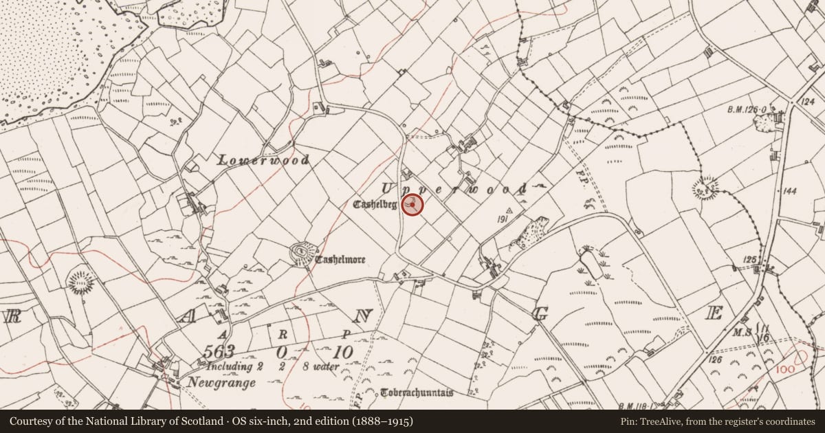
- Latest-edition OS map
- Cashelbeg
- Coordinates
- 54.40004, -8.52244
- SMR number
- SL005-032----
Slide toward Today to fade the historical sheet and see the modern map underneath.
David Rumsey Map Collection, Stanford LibrariesDavid Rumsey Map Collection, Stanford LibrariesDavid Rumsey Map Collection, Stanford LibrariesDavid Rumsey Map Collection, Stanford Libraries
4 historical maps cover this location, the earliest the 1869 map "Ireland." (David Rumsey Map Collection, Stanford Libraries).
Historical maps covering this location
- 1869 · Ireland. (David Rumsey Map Collection, Stanford Libraries)
- 1891 · Ireland 16 (David Rumsey Map Collection, Stanford Libraries)
- 1904 · Sheet 4. (David Rumsey Map Collection, Stanford Libraries)
- 1922 · Ireland - northern section. (David Rumsey Map Collection, Stanford Libraries)
This record in the National Monuments Service's Historic Environment Viewer ↗
The National Monuments Service's description
Situated on a slight NW-facing slope in gently undulating pasture. Remains comprise a roughly oval area (dims. 22m E-W; 19.4m N-S) enclosed by a wall of limestone rubble (Wth top 1.8m; Wth base 2.2m; int. H 1.35m). This cashel was originally circular (diam 19.4m N-S) but it has been reconstructed and extended to the W as far as a public roadway to form a small field. The original cashel wall encloses the site NNW-SE. A narrower (Wth 0.7m) modern reconstructed drystone wall lies along the line of the original wall NW-NNW and SE-SW. The original cashel wall is absent SW-NW. The reconstructed wall extends W 3m beyond the line of the now absent original wall to link to a modern NE-SW orientated drystone field wall. A break (Wth 1.5m) in the original wall at SE marks the position of the original entrance. A modern NW-SE orientated drystone field wall links to the external face of the cashel wall at SE. A modern, now disused, sheep pen (dims 2.4m NE-SW; 1.85m NW-SE) has been constructed in the angle between the cashel wall and the field wall on the N side of the field wall.
Compiled by: Patrick F. O'Donovan
Date of upload: 21 April 2011
Nearby in the register
- Ringfort - cashelunder 1 mi
- Ringfort - unclassifiedunder 1 mi
- Hut siteunder 1 mi
- Burnt moundunder 1 mi
Other entries of the same register within about three miles of this one, by straight line.