Sites and Monuments Record · Ireland
Cross-slab
Inishmurray, County Sligo, Ireland
The record
- Townland
- Inishmurray
- County
- Sligo
- Country
- Ireland
- Latest-edition OS map
- Not indicated
- Coordinates
- 54.43158, -8.65705
- SMR number
- SL001-001056-
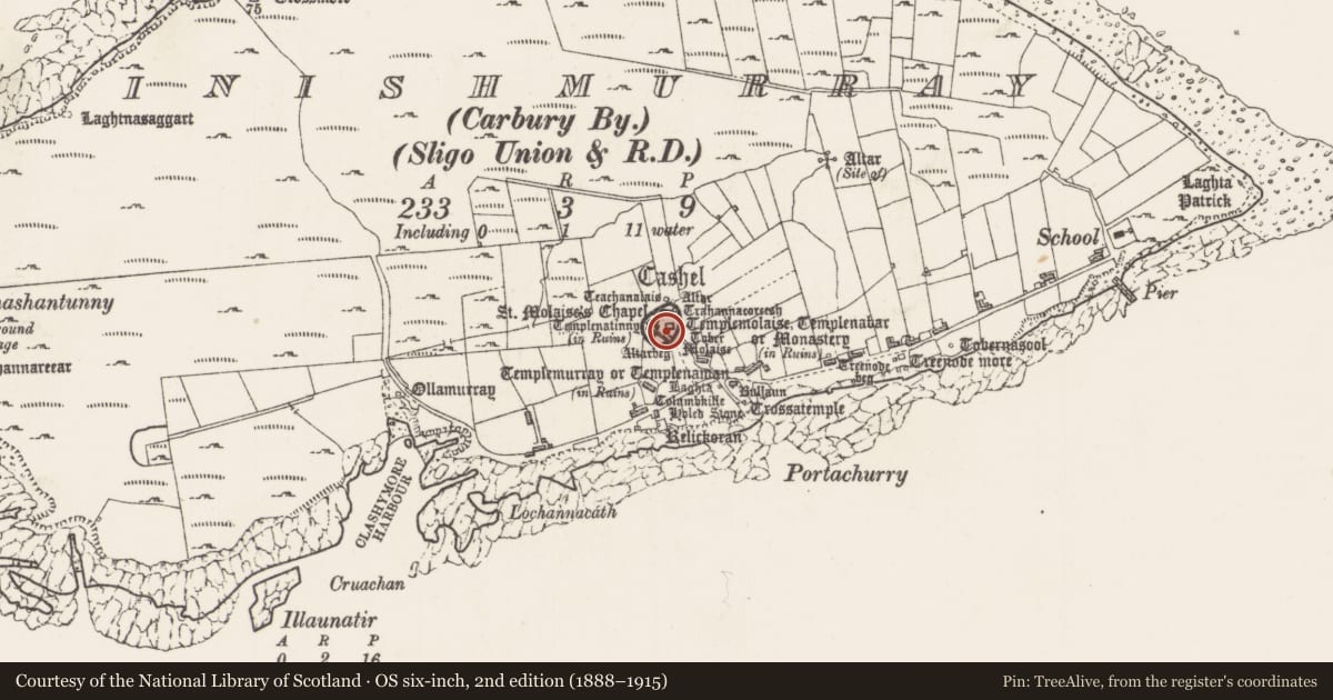
Slide toward Today to fade the historical sheet and see the modern map underneath.
David Rumsey Map Collection, Stanford LibrariesDavid Rumsey Map Collection, Stanford LibrariesDavid Rumsey Map Collection, Stanford LibrariesDavid Rumsey Map Collection, Stanford Libraries
4 historical maps cover this location, the earliest the 1869 map "Ireland." (David Rumsey Map Collection, Stanford Libraries).
Historical maps covering this location
- 1869 · Ireland. (David Rumsey Map Collection, Stanford Libraries)
- 1891 · Ireland 16 (David Rumsey Map Collection, Stanford Libraries)
- 1904 · Sheet 4. (David Rumsey Map Collection, Stanford Libraries)
- 1922 · Ireland - northern section. (David Rumsey Map Collection, Stanford Libraries)
This record in the National Monuments Service's Historic Environment Viewer ↗
The National Monuments Service's description
Located in the ecclesiastical enclosure/cashel (SL001-001001-), to SE of Teach Molaise (SL001-001005-).
Tapering slab (H: 1.20 m, W: 0.596 m, 0.136 m) whose upper two thirds is filled with a cross (0.828 m by 0.496 m) formed of U-shaped cuts 0.04 m wide. The cross arms curve steadily into each other at the crossing and the space created is filled with a low false-relief boss (Diam: 0.092 m). The upper arm has an expanded serif terminal with proud butt, while the left arm has a slightly cusped butt (0.108 m). The terminal of the right arm has been lost. The shaft tapers as it descends dividing at the base to form a mirrored pair of slightly irregular inward turning curls (0.116 m across). A small triangle in false relief occurs directly above these.
Although currently recumbent this monument may originally have been upright.
The above description is derived from the results of a survey of the archaeological monuments on Inishmurray undertaken in 1997-1999 and published in:
Jerry O’Sullivan and Tomás Ó Carragáin 2008 Inishmurrary. Monks and pilgrims in an Atlantic landscape. Volume 1: Archaeological Survey and Excavations 1997-2000. Cork. The Collins Press.
Date of upload: 12 March 2018
Nearby in the register
- Cross-slabunder 1 mi
- Cross-slabunder 1 mi
- Inscribed slabunder 1 mi
- Cross-slabunder 1 mi
Other entries of the same register within about three miles of this one, by straight line.