Sites and Monuments Record · Ireland
Barrow - stepped barrow
Coolagarry (Athlone South By.), County Roscommon, Ireland
The record
- Townland
- Coolagarry (Athlone South By.)
- County
- Roscommon
- Country
- Ireland
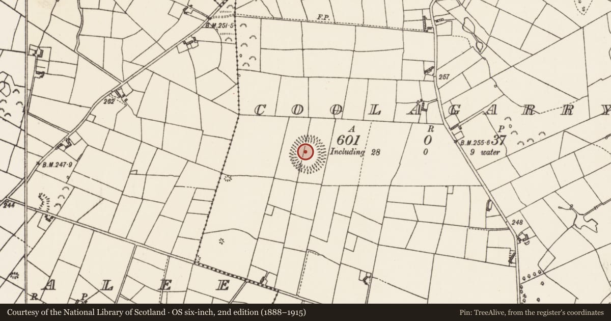
- First-edition OS map
- Embanked enclosure
- Latest-edition OS map
- Hachured
- Coordinates
- 53.48234, -8.15519
- SMR number
- RO048-002001-
Slide toward Today to fade the historical sheet and see the modern map underneath.
David Rumsey Map Collection, Stanford LibrariesDavid Rumsey Map Collection, Stanford LibrariesDavid Rumsey Map Collection, Stanford LibrariesDavid Rumsey Map Collection, Stanford Libraries
4 historical maps cover this location, the earliest the 1790 map "Composite: Ireland." (David Rumsey Map Collection, Stanford Libraries).
Historical maps covering this location
- 1790 · Composite: Ireland. (David Rumsey Map Collection, Stanford Libraries)
- 1811 · Ireland. (David Rumsey Map Collection, Stanford Libraries)
- 1869 · Ireland. (David Rumsey Map Collection, Stanford Libraries)
- 1891 · Ireland 16 (David Rumsey Map Collection, Stanford Libraries)
This record in the National Monuments Service's Historic Environment Viewer ↗
The National Monuments Service's description
On a slight E-W rise. Circular, slightly domed and grass-covered platform (diam.42m NNW-SSE; 40.5m ENE-WSW) defined by scarps (Wth 5-6m; H 2m) separated by a fosse (Wth of top 16.8-19m; Wth of base 8m) from an overgrown earthen bank (Wth of base 8.5-10m; Wth of top 1m; int. H 2m; ext. H c. 4m). This has an outer overgrown fosse (Wth of top 10m; Wth of base 2.5-3m; ext. D c. 2m), which is complete (max. ext. diam. 100m NNW-SSE). There is a second outer bank (Wth 3m) NNE-SE which might not be original as it is separated from the fosse by a slight berm (Wth c. 1m). There is an entrance through the outer bank (Wth 4m) with a causeway (Wth 3m) on to the platform (Wth 2-3.6m) at ENE, but a more recent entrance and causeway is at SSW while a N-S field wall overlies the monument towards the W edge of the platform. Cairn (RO048-002002-) is c. 20m to the NE.
See the attached aerial views taken from the W (001) and N (002).
Compiled by: Michael Moore
Date of upload: 24 August 2010
Nearby in the register
- Cairn - unclassifiedunder 1 mi
- Ringfort - rathunder 1 mi
- Castle - unclassifiedunder 1 mi
- Stone headunder 1 mi
Other entries of the same register within about three miles of this one, by straight line.