Sites and Monuments Record · Ireland
Kiln - corn-drying
Ranelagh, County Roscommon, Ireland
The record
- Townland
- Ranelagh
- County
- Roscommon
- Country
- Ireland
- First-edition OS map
- Not indicated
- Latest-edition OS map
- Not indicated
- Coordinates
- 53.65260, -8.19473
- SMR number
- RO039-102004-
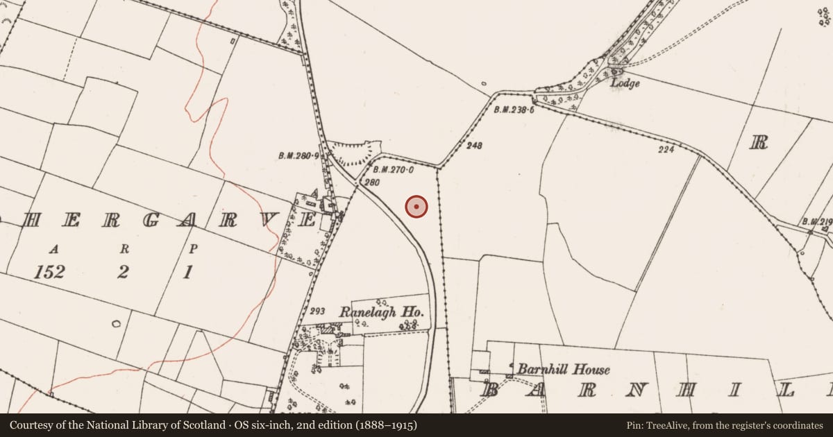
Slide toward Today to fade the historical sheet and see the modern map underneath.
David Rumsey Map Collection, Stanford LibrariesDavid Rumsey Map Collection, Stanford LibrariesDavid Rumsey Map Collection, Stanford LibrariesDavid Rumsey Map Collection, Stanford Libraries
4 historical maps cover this location, the earliest the 1790 map "Composite: Ireland." (David Rumsey Map Collection, Stanford Libraries).
Historical maps covering this location
- 1790 · Composite: Ireland. (David Rumsey Map Collection, Stanford Libraries)
- 1811 · Ireland. (David Rumsey Map Collection, Stanford Libraries)
- 1869 · Ireland. (David Rumsey Map Collection, Stanford Libraries)
- 1891 · Ireland 16 (David Rumsey Map Collection, Stanford Libraries)
This record in the National Monuments Service's Historic Environment Viewer ↗
The National Monuments Service's description
One of the two kilns within Enclosure A was in the area occupied by its bank and must pre-date or post-date it. Another kiln was W of Enclosure A, but within Enclosure B. These kilns were of the figure-of-eight type (L 2.2-2.3m; Wth 0.85-1.36; D 0.3-0.52m), but the fourth kiln was keyhole-shaped (dims 4.13m 0.94m; D 0.55m) and placed in the fosse of Enclosure C at SE. It was stone-lined, had six fills and a fire-reddened base, and is undoubtedly late. The charcoal pit (dims 1.57m x 0.66m; D 0.34m), which may have been another kiln, was located in the passage between the fosses of Enclosure A at SE. It was truncated by the outer fosse, which it must pre-date. This feature contained two sandy upper fills, but the lower fill was mostly charcoal with some ash and had a fire-reddened base. (Delaney and Ní Cheallacháin 2017, 16, 18, 20)
Compiled by: Michael Moore
Date of upload: 8 December 2020
References
Delaney, S. and Ní Cheallacháin, M. 2017 Preliminary Report on Excavations at Ranelagh 1, Co. Roscommon. Licence: 15E0136. Unpublished report, IAC Archaeology
Nearby in the register
- Concentric enclosureunder 1 mi
- Habitation siteunder 1 mi
- Souterrainunder 1 mi
- Souterrainunder 1 mi
Other entries of the same register within about three miles of this one, by straight line.