Sites and Monuments Record · Ireland
Mill - unclassified
Castlecoote, County Roscommon, Ireland
The record
- Townland
- Castlecoote
- County
- Roscommon
- Country
- Ireland
- First-edition OS map
- Indicated
- Latest-edition OS map
- Indicated
- Coordinates
- 53.61637, -8.29011
- SMR number
- RO039-061004-
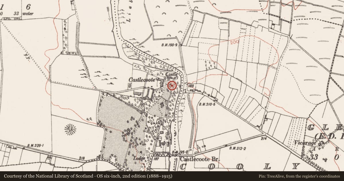
Slide toward Today to fade the historical sheet and see the modern map underneath.
David Rumsey Map Collection, Stanford LibrariesDavid Rumsey Map Collection, Stanford LibrariesDavid Rumsey Map Collection, Stanford LibrariesDavid Rumsey Map Collection, Stanford Libraries
4 historical maps cover this location, the earliest the 1790 map "Composite: Ireland." (David Rumsey Map Collection, Stanford Libraries).
Historical maps covering this location
- 1790 · Composite: Ireland. (David Rumsey Map Collection, Stanford Libraries)
- 1811 · Ireland. (David Rumsey Map Collection, Stanford Libraries)
- 1869 · Ireland. (David Rumsey Map Collection, Stanford Libraries)
- 1891 · Ireland 16 (David Rumsey Map Collection, Stanford Libraries)
This record in the National Monuments Service's Historic Environment Viewer ↗
The National Monuments Service's description
A watermill is listed in inquisitions of 1584 and 1611 (Connellan 1962-3, 4). A millrace departed from the River Suck just W of the point where the W-E section of the river turns S. It ran S (L c. 200m) at the base of the bluff on which the fortified houses (RO039-061001-; RO039-061002-) were built. It was widened in the 18th century and survives (Wth c. 5m) revetted with stone walls where it passes Castlecoote House (L c. 40m), but defined by an eathen bank (Wth 5m; H 1.5m) on the E side futher S. The mill would have been in Casltecoote village where the it was developed further in the 18th century and no evidence of an early structure survives. The widened millrace could have destroyed the most westerly arch of the bridge (RO039-061003-), and truncated the W side of the spherical chamber of the ice-house (RO039-0611-).
Compiled by: Michael Moore
Date of upload: 24 August 2010
References
Connellan, A.M.J. 1962-3 Ballygeraghty and Castlecoote. Journal of the Galway Archaeological and Historical Society 30, 3-6.
Nearby in the register
- House - fortified houseunder 1 mi
- Bridgeunder 1 mi
- Icehouseunder 1 mi
- House - fortified houseunder 1 mi
Other entries of the same register within about three miles of this one, by straight line.