Sites and Monuments Record · Ireland
Ringfort - rath
Rathbrenan, County Roscommon, Ireland
The record
- Townland
- Rathbrenan
- County
- Roscommon
- Country
- Ireland
- First-edition OS map
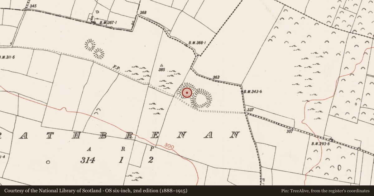
- Embanked enclosure
- Latest-edition OS map
- Hachured
- Coordinates
- 53.64139, -8.24591
- SMR number
- RO039-035001-
Slide toward Today to fade the historical sheet and see the modern map underneath.
David Rumsey Map Collection, Stanford LibrariesDavid Rumsey Map Collection, Stanford LibrariesDavid Rumsey Map Collection, Stanford LibrariesDavid Rumsey Map Collection, Stanford Libraries
4 historical maps cover this location, the earliest the 1790 map "Composite: Ireland." (David Rumsey Map Collection, Stanford Libraries).
Historical maps covering this location
- 1790 · Composite: Ireland. (David Rumsey Map Collection, Stanford Libraries)
- 1811 · Ireland. (David Rumsey Map Collection, Stanford Libraries)
- 1869 · Ireland. (David Rumsey Map Collection, Stanford Libraries)
- 1891 · Ireland 16 (David Rumsey Map Collection, Stanford Libraries)
This record in the National Monuments Service's Historic Environment Viewer ↗
The National Monuments Service's description
Located at the crest of the SE-facing slope of a NW-SE ridge. Circular grass-covered area (diam. 57.8m NW-SE; 53.8m NE-SW) defined by an overgrown earthen bank (Wth 4.6-5.4m; int. H 0.3-0.45m; ext. H 1.3-2.25m), and an outer rounded fosse (Wth of top 5.8-6.8m; Wth of base 1.8-3m; D 0.35-0.6m). There are entrances at NE (Wth 2m), S (Wth 3.5m), WNW (Wth 2m) and ESE (Wth 2m), the latter with a causeway connecting to rath (RO039-035002-), whose fosse appears to cut that of this rath, although the causeway might not be original (max. ext. diam. 66.4m N-S). There was a subrectangular enclosure or annexe (RO039-035004-) (dims c. 100m E-W; c. 70m N-S) or, more probably, a field bank to the S, connecting with rath (RO039-035002-) and defined by an earthen bank and fosse (Wth c. 2m; D c. 0.6m) (Knox 1915, 289) that no longer survives.
Compiled by: Michael Moore
Date of upload: 24 August 2010
References
Knox, H.T. 1915 Rath Brenainn. Journal of the Royal Society of Antiquaries of Ireland 45, 287-99.
Nearby in the register
- Ringfort - rathunder 1 mi
- Enclosure - large enclosureunder 1 mi
- Moundunder 1 mi
- Ringfort - rathunder 1 mi
Other entries of the same register within about three miles of this one, by straight line.