Sites and Monuments Record · Ireland
Road - gravel/stone trackway - peatland
Kilbarry, County Roscommon, Ireland
The record
- Townland
- Kilbarry
- County
- Roscommon
- Country
- Ireland
- First-edition OS map
- Not indicated
- Latest-edition OS map
- Not indicated
- Coordinates
- 53.77385, -7.90452
- SMR number
- RO030-017----
Slide toward Today to fade the historical sheet and see the modern map underneath.
David Rumsey Map Collection, Stanford LibrariesDavid Rumsey Map Collection, Stanford LibrariesDavid Rumsey Map Collection, Stanford LibrariesDavid Rumsey Map Collection, Stanford Libraries
4 historical maps cover this location, the earliest the 1790 map "Composite: Ireland." (David Rumsey Map Collection, Stanford Libraries).
Historical maps covering this location
- 1790 · Composite: Ireland. (David Rumsey Map Collection, Stanford Libraries)
- 1811 · Ireland. (David Rumsey Map Collection, Stanford Libraries)
- 1869 · Ireland. (David Rumsey Map Collection, Stanford Libraries)
- 1891 · Ireland 16 (David Rumsey Map Collection, Stanford Libraries)
This record in the National Monuments Service's Historic Environment Viewer ↗
The National Monuments Service's description
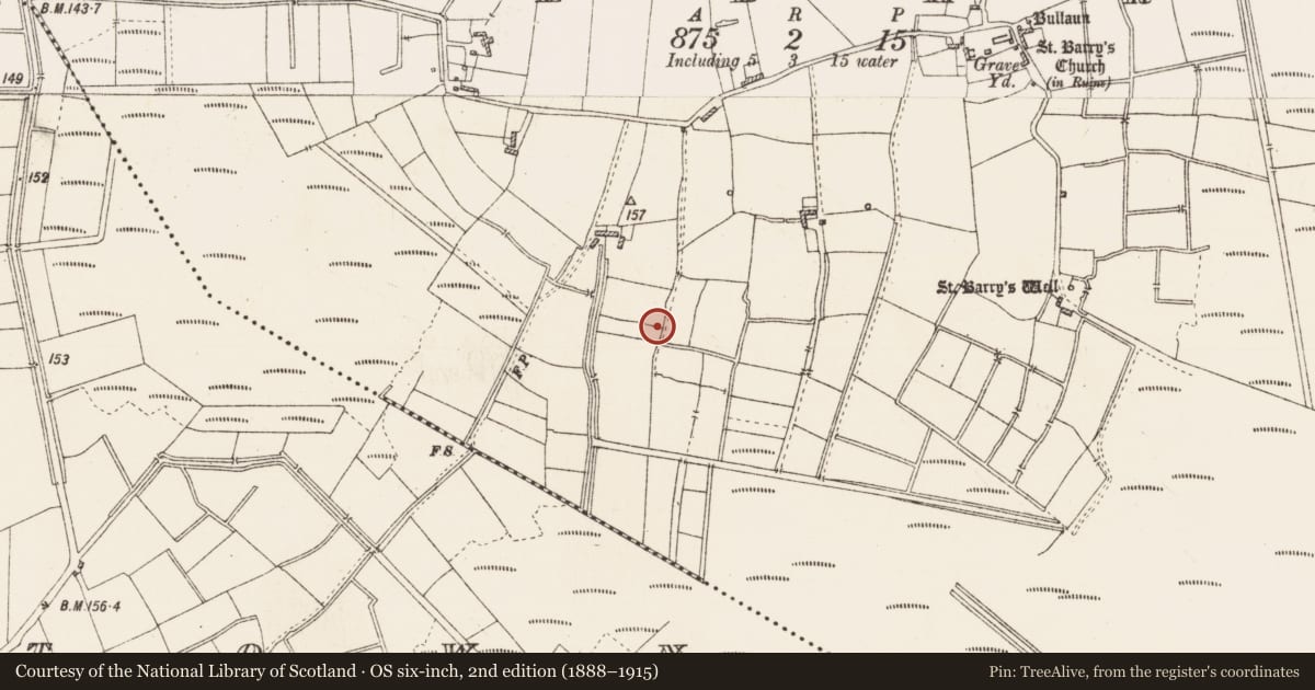
Emerging from a bog and rising up the S-facing slope of the slight E-W ridge on which Kilbarry church (RO024-016001-) is situated. Running NE-SW (L c. 600m) down the side of the ridge, it is known as the 'Saint's Road' and its course is known locally as a direct route between Kilbarry church and the RC church of Whitehall where St. Barry's Boat (RO030-007----) is kept. At the bottom of the slope it proceeds N (L c. 300m) on the E side of a N-S field bank where it is barely noticeable at the S end as a slight berm (Wth c. 3-5m), before swinging NE across fields (L c. 450m) to meet the public road c. 80m W of the graveyard (RO024-016002-). It is reputed locally to have a metalled surface that can be detected in parched conditions. Archaeological testing (16E0174) by A. Wallace just to the NW at a point where the old road approaches the E-W public road produced no related material (excavations.ie 2016:857).
Compiled by: Michael Moore
Date of upload: 24 August 2010
Amended: 20 October 2021
Nearby in the register
- Crannogunder 1 mi
- Buildingunder 1 mi
- Ritual site - holy wellunder 1 mi
- Buildingunder 1 mi
Other entries of the same register within about three miles of this one, by straight line.