Sites and Monuments Record · Ireland
Barrow - mound barrow
Sheegeeragh, County Roscommon, Ireland
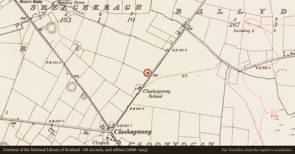
The record
- Townland
- Sheegeeragh
- County
- Roscommon
- Country
- Ireland
- First-edition OS map
- Not indicated
- Latest-edition OS map
- Hachured
- Coordinates
- 53.74774, -8.22291
- SMR number
- RO028-138001-
Slide toward Today to fade the historical sheet and see the modern map underneath.
David Rumsey Map Collection, Stanford LibrariesDavid Rumsey Map Collection, Stanford LibrariesDavid Rumsey Map Collection, Stanford LibrariesDavid Rumsey Map Collection, Stanford Libraries
4 historical maps cover this location, the earliest the 1790 map "Composite: Ireland." (David Rumsey Map Collection, Stanford Libraries).
Historical maps covering this location
- 1790 · Composite: Ireland. (David Rumsey Map Collection, Stanford Libraries)
- 1811 · Ireland. (David Rumsey Map Collection, Stanford Libraries)
- 1869 · Ireland. (David Rumsey Map Collection, Stanford Libraries)
- 1891 · Ireland 16 (David Rumsey Map Collection, Stanford Libraries)
This record in the National Monuments Service's Historic Environment Viewer ↗
The National Monuments Service's description
On top of the low WNW-ESE ridge of Caran Hill. Subcircular grass-covered and domed mound (dims 23m E-W; c. 20m N-S; H 1.7-2m) with the base of a small grass-covered cairn (RO028-138002-) (diam. 2.2m E-W; 1.8m N-S; H 0.5m), probably a clearance cairn, on the summit. The base of the mound is cut back slightly at N where there is a pond. It is described as a passage tomb (Ó Nualláin 1968, 27; Herity 1974, 280, Ro 4; de Valera and O'Nuallain 1972, 141-2). Archaeological testing (20E0594) by R. Ó Maoldúin just to the NE on the site of a proposed lay-by produced no related material (excavations.ie 2020:188).
Compiled by: Michael Moore
Date of upload: 24 August 2010
Amended: 20 October 2021
See linked document with details from Ruaidhrí de Valera and Seán Ó Nualláin, Survey of the Megalithic Tombs of Ireland. Volume III. Counties Galway, Roscommon, Leitrim, Longford, Westmeath, Laoighis, Offaly, Kildare, Cavan. (Dublin: Stationery Office, 1972).
References
Herity, M. 1974 Irish Passage Graves. Dublin. Irish University Press.
de Valera, R. and Ó Nualláin, S. 1972 Survey of the megalithic tombs of Ireland, vol. 3, Counties Galway, Roscommon, Leitrim, Longford, Westmeath, Laoighis, Offaly, Kildare, Cavan. Dublin. Stationery Office.
Ó Nualláin, S. 1968 A ruined megalithic cemetery in Co. Donegal and its context in the Irish passage grave series. Journal of the Royal Society of Antiquaries of Ireland 98, 1-29.
Nearby in the register
- Cairn - clearance cairnunder 1 mi
- Ringfort - rathunder 1 mi
- Souterrainunder 1 mi
- Souterrainunder 1 mi
Other entries of the same register within about three miles of this one, by straight line.