Sites and Monuments Record · Ireland
Building
Carns, County Roscommon, Ireland
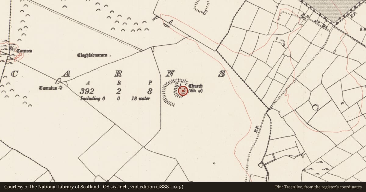
The record
- Townland
- Carns
- County
- Roscommon
- Country
- Ireland
- First-edition OS map
- Not indicated
- Latest-edition OS map
- Not indicated
- Coordinates
- 53.75392, -8.25488
- SMR number
- RO028-075001-
Slide toward Today to fade the historical sheet and see the modern map underneath.
David Rumsey Map Collection, Stanford LibrariesDavid Rumsey Map Collection, Stanford LibrariesDavid Rumsey Map Collection, Stanford LibrariesDavid Rumsey Map Collection, Stanford Libraries
4 historical maps cover this location, the earliest the 1790 map "Composite: Ireland." (David Rumsey Map Collection, Stanford Libraries).
Historical maps covering this location
- 1790 · Composite: Ireland. (David Rumsey Map Collection, Stanford Libraries)
- 1811 · Ireland. (David Rumsey Map Collection, Stanford Libraries)
- 1869 · Ireland. (David Rumsey Map Collection, Stanford Libraries)
- 1891 · Ireland 16 (David Rumsey Map Collection, Stanford Libraries)
This record in the National Monuments Service's Historic Environment Viewer ↗
The National Monuments Service's description
On a SE-facing slope at the E end of the Carnfree ridge, and just W of the church (RO028-075005-). This is a rectangular structure (ext. dims 13.8m WNW-ESE; 7m NNE-SSW) which was defined by stone walls (Wth c. 1m; H 0.5m) with entrances at the centre of the N (Wth 1.2m) and S (Wth 1.7m) walls which on excavation (06E0655) is identified as a possible priest's house (Shanahan 2006, 6-9; 2009a, 455-6). The church (RO028-075005-), is immediately to the E but the priest's house is within a rectangular enclosure (RO028-075002-).
Compiled by: Michael Moore
Date of upload: 13th September, 2010.
References
Shanahan, B. 2009a Carns. Church site, deserted settlement and field system, possibly prehistoric. In I. Bennett (ed.), Excavations 2006: summary accounts of archaeological excavations in Ireland, 455-6, No. 1715. Dublin. Wordwell.
Shanahan, B. 2006 Recent research in Roscommon by the Discovery Programme's Medieval Rural Settlement Project. Bullitin of the Group for the Study of Historic Irish Settlement, No. 11, 1-9.
Nearby in the register
- Ogham stoneunder 1 mi
- Burialunder 1 mi
- Children's burial groundunder 1 mi
- Churchunder 1 mi
Other entries of the same register within about three miles of this one, by straight line.