Sites and Monuments Record · Ireland
Crannog
Ballintober, County Roscommon, Ireland
The record
- Townland
- Ballintober
- County
- Roscommon
- Country
- Ireland
- First-edition OS map
- Not indicated
- Latest-edition OS map
- Not indicated
- Coordinates
- 53.72150, -8.40842
- SMR number
- RO027-048025-
Slide toward Today to fade the historical sheet and see the modern map underneath.
David Rumsey Map Collection, Stanford LibrariesDavid Rumsey Map Collection, Stanford LibrariesDavid Rumsey Map Collection, Stanford LibrariesDavid Rumsey Map Collection, Stanford Libraries
4 historical maps cover this location, the earliest the 1790 map "Composite: Ireland." (David Rumsey Map Collection, Stanford Libraries).
Historical maps covering this location
- 1790 · Composite: Ireland. (David Rumsey Map Collection, Stanford Libraries)
- 1811 · Ireland. (David Rumsey Map Collection, Stanford Libraries)
- 1869 · Ireland. (David Rumsey Map Collection, Stanford Libraries)
- 1891 · Ireland 16 (David Rumsey Map Collection, Stanford Libraries)
This record in the National Monuments Service's Historic Environment Viewer ↗
The National Monuments Service's description
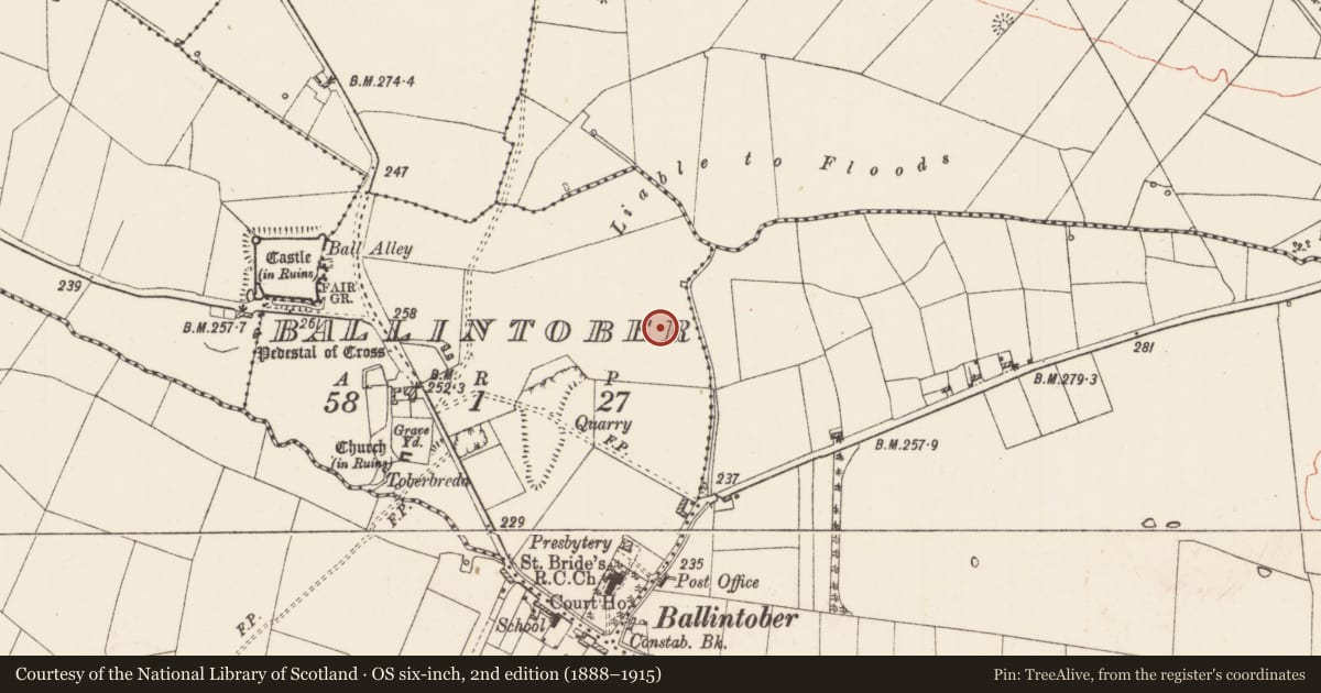
Situated in a broad hollow c. 300m E of Ballintober castle (RO027-048002-). The outline of an oval lake (dims c. 600m E-W; c. 250-350m N-S) is depicted on the OS 6-inch editions of 1835 and 1908 as a marshy area liable to flooding. Two oval mounds that are c. 10m apart at the S edge of this turlough were fully surveyed and subjected to magnetometer and ground penetrating radar surveys (15R0051) during 2016-17. The W mound (dims of base c. 20m E-W; c. 10m N-S; H c. 2m) shows evidence of what might be a large hearth (diam. c. 2m) in its interior. The E mound (dims c. 14m E-W; c. 5m N-S; H c. 1m) is less well defined with a hollow on its SW side. From the location at the edge of the turlough it is quite possible that they are the remains of a crannog. (Brady et al. 2017, 40)
Compiled by: Michael Moore
Date of upload: 24 November 2020
References
Brady, N., Connell, S., Maurer, K., Cearley, D. and L. Conyers 2017 Archaeological Excavation and Survey. Ballintober Castle and precinct, Ballintober, Co. Roscommon. Licences: 15E0232; 15R0051. 2016 season. Unpublished report. Castles in Communities: medieval Ireland Past and Present
Nearby in the register
- Field systemunder 1 mi
- Road - road/trackwayunder 1 mi
- Settlement deserted - medievalunder 1 mi
- Cross - Market crossunder 1 mi
Other entries of the same register within about three miles of this one, by straight line.