Sites and Monuments Record · Ireland
Church
Termon More, County Roscommon, Ireland
The record
- Townland
- Termon More
- County
- Roscommon
- Country
- Ireland
- First-edition OS map
- Church
- Latest-edition OS map
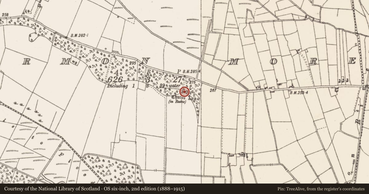
- Church (in Ruins)
- Coordinates
- 53.77212, -8.46383
- SMR number
- RO026-034----
Slide toward Today to fade the historical sheet and see the modern map underneath.
David Rumsey Map Collection, Stanford LibrariesDavid Rumsey Map Collection, Stanford LibrariesDavid Rumsey Map Collection, Stanford LibrariesDavid Rumsey Map Collection, Stanford Libraries
4 historical maps cover this location, the earliest the 1790 map "Composite: Ireland." (David Rumsey Map Collection, Stanford Libraries).
Historical maps covering this location
- 1790 · Composite: Ireland. (David Rumsey Map Collection, Stanford Libraries)
- 1811 · Ireland. (David Rumsey Map Collection, Stanford Libraries)
- 1869 · Ireland. (David Rumsey Map Collection, Stanford Libraries)
- 1891 · Ireland 16 (David Rumsey Map Collection, Stanford Libraries)
This record in the National Monuments Service's Historic Environment Viewer ↗
The National Monuments Service's description
On the crest towards the SE end of a low NW-SE ridge. St Caolainn traced her ancestry to the Ciarraighe of Kerry, a subject people in Connaught who had settled around Castlerea. She gouged out her eyes rather than be admired for them (Anon 1980; Ó Rian 2011, 151-2). This may be the location of St Caolainn’s church and it is connected to the convent at Moor (RO020-043003-) c. 1.2 km to the N by a road (RO020-044----). Only a fragment of the E gable (L 3.2m; T 0.95m; H 4.1m) with the N side of a simple light (H 0.5m) survives together with an adjacent piece of the grass-covered S wall (L 2.9m; H 0.5m). There is no graveyard or enclosure. (Timoney 1990, 15)
Compiled by: Michael Moore
Date of revised upload: 9 April 2018
References
Anon. 1980 Tarmon - Caolainne. In Tarmon National School Centenary, 9-11.
Ó Riain, P. 2011 A dictionary of Irish Saints. Dublin. Four Courts Press.
Timoney, M. A. 1990 The changing landscape around Tarmon, Co. Roscommon. In M. Lavin (ed.) Tarmon National School Centenary 1890-1990, 13-16.
Nearby in the register
- Enclosureunder 1 mi
- Road - road/trackwayunder 1 mi
- Quarryunder 1 mi
- Standing stoneunder 1 mi
Other entries of the same register within about three miles of this one, by straight line.