Sites and Monuments Record · Ireland
Concentric enclosure
Corracreigh, County Roscommon, Ireland
The record
- Townland
- Corracreigh
- County
- Roscommon
- Country
- Ireland
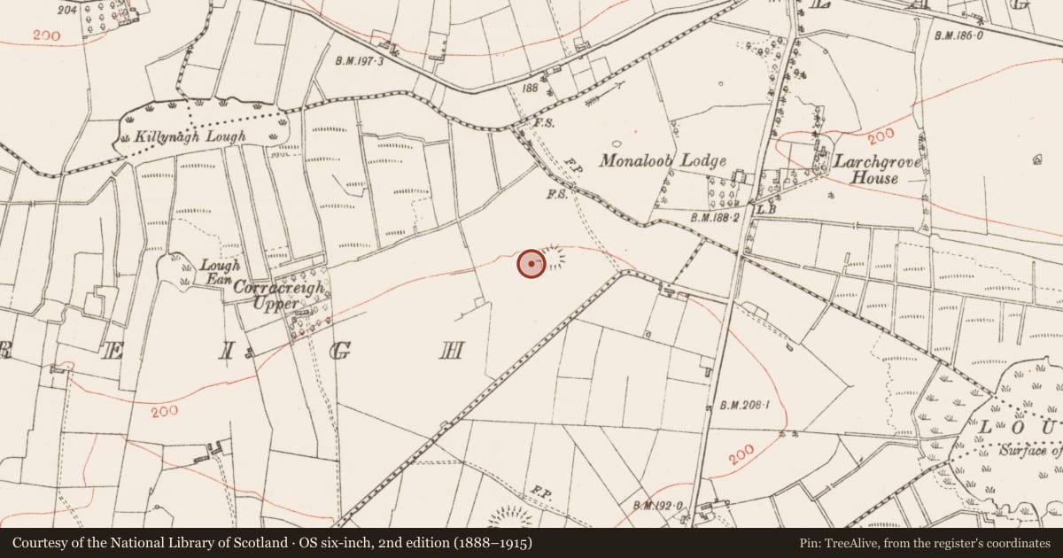
- First-edition OS map
- Embanked enclosure
- Latest-edition OS map
- Hachured
- Coordinates
- 53.80403, -8.19960
- SMR number
- RO022-075001-
Slide toward Today to fade the historical sheet and see the modern map underneath.
David Rumsey Map Collection, Stanford LibrariesDavid Rumsey Map Collection, Stanford LibrariesDavid Rumsey Map Collection, Stanford LibrariesDavid Rumsey Map Collection, Stanford Libraries
4 historical maps cover this location, the earliest the 1790 map "Composite: Ireland." (David Rumsey Map Collection, Stanford Libraries).
Historical maps covering this location
- 1790 · Composite: Ireland. (David Rumsey Map Collection, Stanford Libraries)
- 1811 · Ireland. (David Rumsey Map Collection, Stanford Libraries)
- 1869 · Ireland. (David Rumsey Map Collection, Stanford Libraries)
- 1891 · Ireland 16 (David Rumsey Map Collection, Stanford Libraries)
This record in the National Monuments Service's Historic Environment Viewer ↗
The National Monuments Service's description
On a N-facing slope. Oval grass-covered area (dims 89m E-W; 66m N-S) defined by an earthen bank (Wth 5m; H 0.2-0.3m) which is reduced to a low scarp (H 0.2-0.4m) at N and S. A rectangular enclosure (RO022-075002-) (dims 26m E-W; 17m N-S) defined by an earthen bank (Wth 4m) at W and scarps elsewhere is attached to the inside of the perimeter at N, and a rectangular enclosure (RO022-075003-) with some bushes (dims 25m E-W; 24m N-S) defined by the base of a wall (Wth 1.5m) at W and scarps at N and S is attached to the inside of the perimeter at E. There is no identifiable entrance.
The oval enclosure is within a circular outer enclosure (diam. 177m E-W; 162m N-S) defined by an earthen bank (Wth 5-7m; H 0.2-0.3m) N-W-SW, with slight traces of a fosse (Wth of top 7m; ext. D 0.1m) at S, and incorporated into a field bank SW-W but reduced to a slight scarp elsewhere. There are no identifiable entrances. Field system (RO022-074----) is c. 180m to the NE.
Compiled by: Michael Moore
Date of upload: 24 August 2010
Nearby in the register
- Enclosureunder 1 mi
- Enclosureunder 1 mi
- Field systemunder 1 mi
- Ringfort - rathunder 1 mi
Other entries of the same register within about three miles of this one, by straight line.