Sites and Monuments Record · Ireland
Church
Kilmurry, County Roscommon, Ireland
The record
- Townland
- Kilmurry
- County
- Roscommon
- Country
- Ireland
- First-edition OS map
- Not indicated
- Latest-edition OS map
- Indicated
- Coordinates
- 53.77977, -8.37790
- SMR number
- RO021-064001-
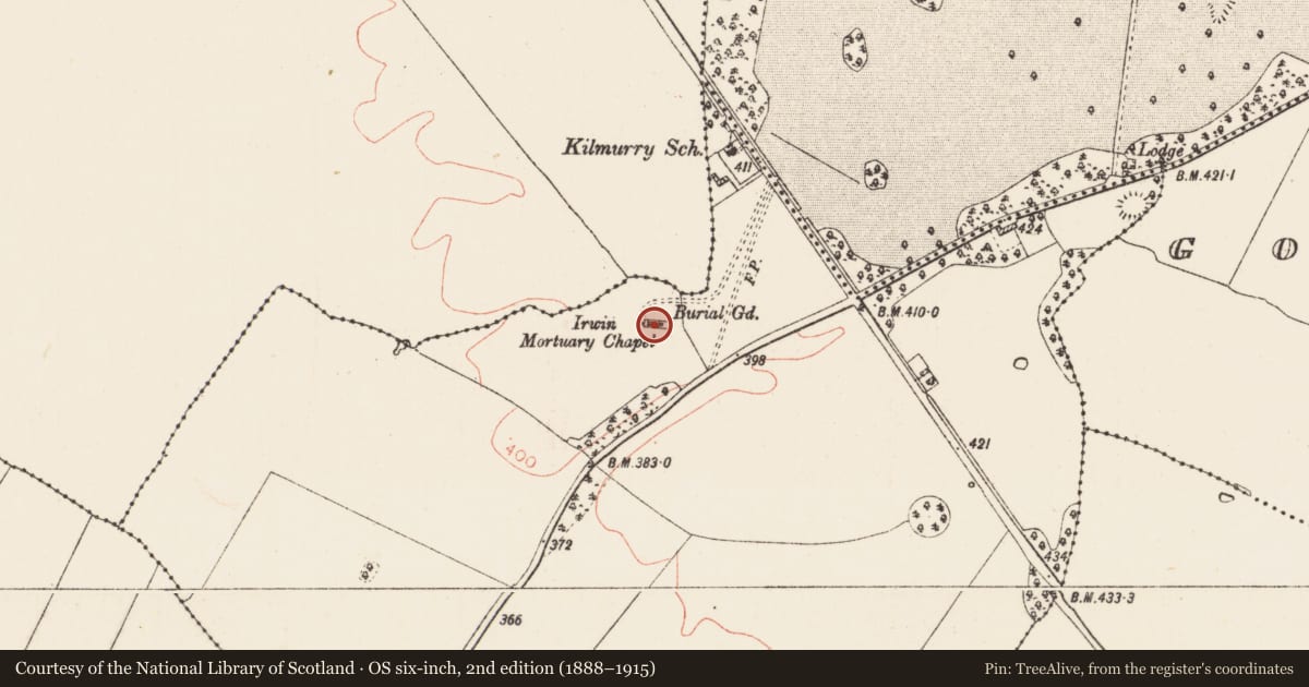
Slide toward Today to fade the historical sheet and see the modern map underneath.
David Rumsey Map Collection, Stanford LibrariesDavid Rumsey Map Collection, Stanford LibrariesDavid Rumsey Map Collection, Stanford LibrariesDavid Rumsey Map Collection, Stanford Libraries
4 historical maps cover this location, the earliest the 1790 map "Composite: Ireland." (David Rumsey Map Collection, Stanford Libraries).
Historical maps covering this location
- 1790 · Composite: Ireland. (David Rumsey Map Collection, Stanford Libraries)
- 1811 · Ireland. (David Rumsey Map Collection, Stanford Libraries)
- 1869 · Ireland. (David Rumsey Map Collection, Stanford Libraries)
- 1891 · Ireland 16 (David Rumsey Map Collection, Stanford Libraries)
This record in the National Monuments Service's Historic Environment Viewer ↗
The National Monuments Service's description
Recorded as a Dominican cell in 1586 (Nicholls 1972-3, 38). Fr. Augustine Plunkett built a refuge and hospice here after the dispersal of an Augustinian house at Ballyhaunis in the 1700s, which would undoubtedly have served as a Roman Catholic church. Situated on a low hillock in an undulating landscape. Rectangular structure (ext. dims 16.8m E-W; 7.8m N-S) with restored and conserved walls (T 0.9m; H 1.8-2m). There is a doorway (Wth 1.2m) towards the W end of the S wall, and the head of a cusped ogee-headed window (RO021-064004-) is built into the outer face of the N wall. A mortuary chapel to the W was built in 1865 for the Irwins of Rathmoyle, and conserved in the 1990s (Mannion 1998). They are within a rectangular graveyard (RO021-064002-) (dims c. 70m E-W; c. 60m N-S) defined by masonry walls. Enclosure (RO021-063005-) and barrow (RO021-063006-) are c. 70m and 140m to the NE and enclosure (RO012-063003-) is c. 150m to the NW.
Compiled by: Michael Moore
Date of upload: 24 August 2010
References
Mannion, L. 1998 The restoration of Rathmoyle ancient cemetery. Journal of the Roscommon Historical and Archaeological Society 7, 143-5.
Nicholls, K. 1972-3 A list of the monasteries in Connacht. Journal of the Galway Archaeological and Historical Society 33, 28-43.
Nearby in the register
- Architectural fragmentunder 1 mi
- Graveyardunder 1 mi
- Enclosureunder 1 mi
- Barrow - embanked barrowunder 1 mi
Other entries of the same register within about three miles of this one, by straight line.