Sites and Monuments Record · Ireland
Religious house - Augustinian, of Arrouaise nuns
Moor, County Roscommon, Ireland
The record
- Townland
- Moor
- County
- Roscommon
- Country
- Ireland
- First-edition OS map
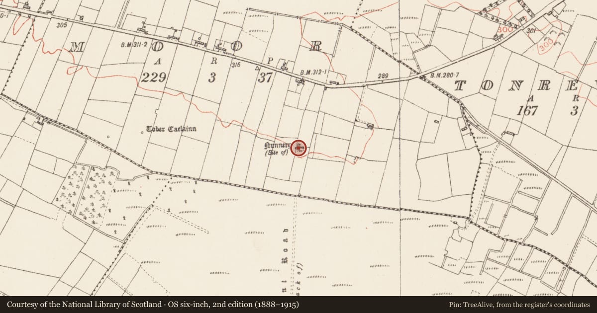
- Nunnery
- Latest-edition OS map
- Nunnery (Site of)
- Coordinates
- 53.78244, -8.46713
- SMR number
- RO020-043001-
Slide toward Today to fade the historical sheet and see the modern map underneath.
David Rumsey Map Collection, Stanford LibrariesDavid Rumsey Map Collection, Stanford LibrariesDavid Rumsey Map Collection, Stanford LibrariesDavid Rumsey Map Collection, Stanford Libraries
4 historical maps cover this location, the earliest the 1790 map "Composite: Ireland." (David Rumsey Map Collection, Stanford Libraries).
Historical maps covering this location
- 1790 · Composite: Ireland. (David Rumsey Map Collection, Stanford Libraries)
- 1811 · Ireland. (David Rumsey Map Collection, Stanford Libraries)
- 1869 · Ireland. (David Rumsey Map Collection, Stanford Libraries)
- 1891 · Ireland 16 (David Rumsey Map Collection, Stanford Libraries)
This record in the National Monuments Service's Historic Environment Viewer ↗
The National Monuments Service's description
Traditionally founded by St Caolin or Caolainn, sometimes described a disciple of St Bridget's (Lupeta 1912). A convent of Arrouaisian nuns, known as Termonkeelin, was founded after 1223, probably by nuns from Derrane (RO040-004001-) and Roscommon (RO039-043006-), and it is listed as Ternumkrum in the ecclesiastical taxation of 1306 (Cal. doc. Ire., vol. 5, 223). Later it became a dependency of Kilcreevanty (GA029-096001-) (Gwynn and Hadcock 1988, 324; Hall 2003, 152, 209). Situated on a gentle S-facing slope.
Raised rectangular grass-covered area (ext. dims 25.5m E-W; 15m N-S; ext. H 0.8m at N to 1.3-1.5m) defined by grass-covered stone spreads (Wth 5.3-7m; int. H 0.2-0.5m) that may be largely field spoil. Some stones which may be in situ from the original walls of the church are visible. There is a tradition that the field to the N was used as a Childrens' Burial Ground (RO020-043002-). Tober Caelainn (RO020-042----) is c. 450m to the W, and a road (RO020-044----) led S from the church to Termon More church site (RO026-034----). Standing stone (RO020-055----) is c. 100m to the SE. (Timoney 1990, 15)
Compiled by: Michael Moore
Date of upload: 24 August 2010
References
Hall, D. 2003 Women and the church in medieval Ireland, c. 1140-1540. Four Courts Press. Dublin.
Lupeta 1912 Saint Brigid's travelling companion. The Catholic Bulletin 2, 207-10.
Gwynn, A. and Hadcock, R.N. 1970 (Reprint 1988) Medieval religious houses of Ireland. Dublin. Irish Academic Press.
Cal. doc. Ire. - Calendar of documents relating to Ireland 1171-1307, ed. H.S. Sweetman (5 vols., London, 1875-86).
Timoney, M. A. 1990 The changing landscape around Tarmon, Co. Roscommon. In M. Lavin (ed.) Tarmon National School Centenary 1890-1990, 13-16.
Nearby in the register
- Children's burial groundunder 1 mi
- Standing stoneunder 1 mi
- Road - road/trackwayunder 1 mi
- Ritual site - holy wellunder 1 mi
Other entries of the same register within about three miles of this one, by straight line.