Sites and Monuments Record · Ireland
Ecclesiastical enclosure
Kilmore (Ballintober North By.), County Roscommon, Ireland
The record
- Townland
- Kilmore (Ballintober North By.)
- County
- Roscommon
- Country
- Ireland
- First-edition OS map
- Not indicated
- Latest-edition OS map
- Not indicated
- Coordinates
- 53.88908, -8.00875
- SMR number
- RO018-002005-
Slide toward Today to fade the historical sheet and see the modern map underneath.
David Rumsey Map Collection, Stanford LibrariesDavid Rumsey Map Collection, Stanford LibrariesDavid Rumsey Map Collection, Stanford LibrariesDavid Rumsey Map Collection, Stanford Libraries
4 historical maps cover this location, the earliest the 1790 map "Composite: Ireland." (David Rumsey Map Collection, Stanford Libraries).
Historical maps covering this location
- 1790 · Composite: Ireland. (David Rumsey Map Collection, Stanford Libraries)
- 1811 · Ireland. (David Rumsey Map Collection, Stanford Libraries)
- 1869 · Ireland. (David Rumsey Map Collection, Stanford Libraries)
- 1891 · Ireland 16 (David Rumsey Map Collection, Stanford Libraries)
This record in the National Monuments Service's Historic Environment Viewer ↗
The National Monuments Service's description
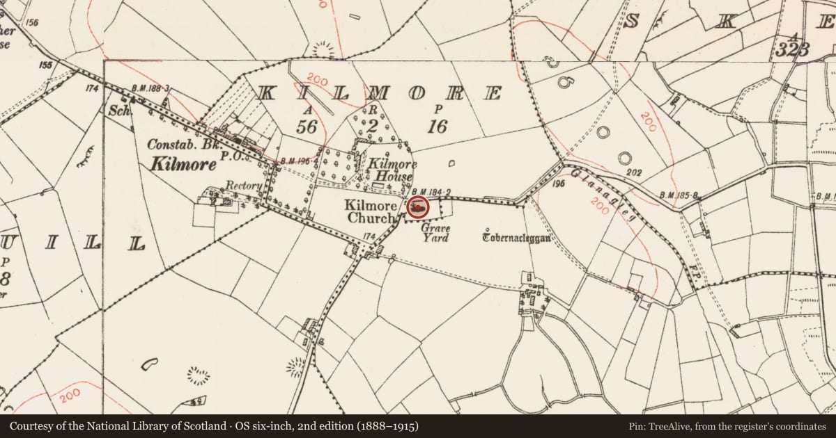
Reported by Mr. Jean-Charles Caillere (8-7-2022). In level pasture and originally enclosing the probable site of the abbey of Kilmore of Tir Briuin na Sinna (RO018-026002*), which was reputedly founded by St Patrick (Stokes 1887b, 95), and later occupied by an Augustinian Abbey (RO018-002003-) and subsequently by a C of I church, and a graveyard (RO018-002004-). ‘Tobermacleggan’ holy well (RO018-003----) lies c. 40m to ESE.
Visible on GoogleEarth aerial imagery dated March 2022 as the cropmarks of the southern section of two enclosing elements surrounding the ecclesiastical site: an inner enclosing bank (est. diam. c. 90m) along with a second, outer enclosing bank (est. diam. c. 140m) are visible E-S-SW of the graveyard.
See attachment RO018-002005-_01 Snip of GoogleEarth aerial image (March 2022) supplied by Mr. Jean-Charles Caillere: enclosing banks arrowed; holy well circled.
Compiled by: Gearóid Conroy
Date of upload: 20 December 2022
References
Stokes, W. 1887 The tripartite life of Patrick, 2 vols. London. HMSO.
Nearby in the register
- Religious house - Augustinian canonsunder 1 mi
- Memorial stoneunder 1 mi
- Graveyardunder 1 mi
- Graveslabunder 1 mi
Other entries of the same register within about three miles of this one, by straight line.