Sites and Monuments Record · Ireland
Church
Kilrooan, County Roscommon, Ireland
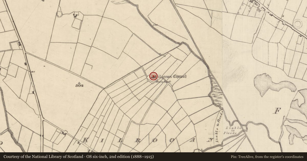
The record
- Townland
- Kilrooan
- County
- Roscommon
- Country
- Ireland
- First-edition OS map
- Kilrooan Church
- Latest-edition OS map
- Kilrooan Church (in Ruins)
- Coordinates
- 53.84904, -8.61721
- SMR number
- RO013-024001-
Slide toward Today to fade the historical sheet and see the modern map underneath.
David Rumsey Map Collection, Stanford LibrariesDavid Rumsey Map Collection, Stanford LibrariesDavid Rumsey Map Collection, Stanford LibrariesDavid Rumsey Map Collection, Stanford Libraries
4 historical maps cover this location, the earliest the 1790 map "Composite: Ireland." (David Rumsey Map Collection, Stanford Libraries).
Historical maps covering this location
- 1790 · Composite: Ireland. (David Rumsey Map Collection, Stanford Libraries)
- 1857 · Ireland (David Rumsey Map Collection, Stanford Libraries)
- 1869 · Ireland. (David Rumsey Map Collection, Stanford Libraries)
- 1891 · Ireland 16 (David Rumsey Map Collection, Stanford Libraries)
This record in the National Monuments Service's Historic Environment Viewer ↗
The National Monuments Service's description
Listed as Kilnardan in the ecclesiastical taxation of Elphin in 1306 (Cal. doc. Ire., vol. 5, 224) and situated on the NE-facing slope of a NW-SE drumlin ridge with the NW-SE river Lung c. 220m to the NE. It may have been a Chapel-of-Ease to the parish church of Tibohine (RO014-021001-), c. 8.5km to the ENE. Interrupted sections of the N wall (L at least 10.8m) including at the E end a section of wall (L 3.8m; T 0.8m; H 2.7m) with an external base batter. It is located in the N part of a rectangular overgrown graveyard (RO013-024002-) (dims 40m NW-SE; c. 15m NE-SW at NW to c. 35m NE-SW at SE) defined by masonry walls with a stile and gate at W. It contains headstones from the late 18th century and grave-markers, and a bullaun stone (RO013-024003-) (dims 0.65m x 0.54-0.74m; H 0.28m) with a single basin (diam. 0.38m; D 0.2m) is inside the gate.
Compiled by: Michael Moore
Date of upload: 24 August 2010
References
Cal. doc. Ire. - Calendar of documents relating to Ireland 1171-1307, ed. H.S. Sweetman (5 vols., London, 1875-86).
Nearby in the register
- Graveyardunder 1 mi
- Bullaun stoneunder 1 mi
- Ringfort - rathunder 1 mi
- Ringfort - rathunder 1 mi
Other entries of the same register within about three miles of this one, by straight line.