Sites and Monuments Record · Ireland
Penal Mass station
Creggan ((Costello By.), County Roscommon, Ireland
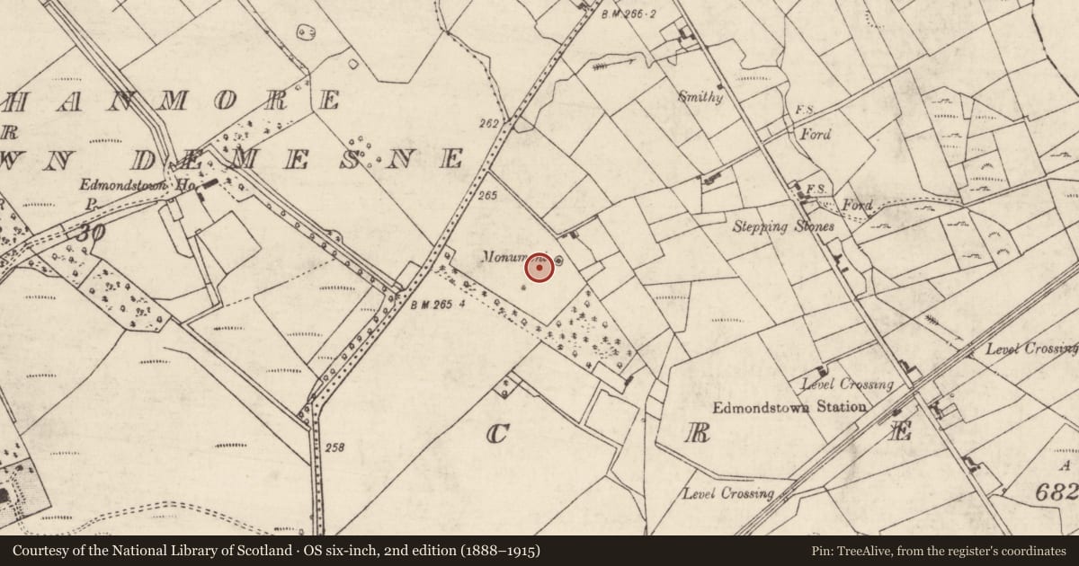
The record
- Townland
- Creggan ((Costello By.)
- County
- Roscommon
- Country
- Ireland
- First-edition OS map
- Monument
- Latest-edition OS map
- Four Altars
- Coordinates
- 53.92380, -8.53099
- SMR number
- RO008-013001-
Slide toward Today to fade the historical sheet and see the modern map underneath.
David Rumsey Map Collection, Stanford LibrariesDavid Rumsey Map Collection, Stanford LibrariesDavid Rumsey Map Collection, Stanford LibrariesDavid Rumsey Map Collection, Stanford Libraries
4 historical maps cover this location, the earliest the 1790 map "Composite: Ireland." (David Rumsey Map Collection, Stanford Libraries).
Historical maps covering this location
- 1790 · Composite: Ireland. (David Rumsey Map Collection, Stanford Libraries)
- 1811 · Ireland. (David Rumsey Map Collection, Stanford Libraries)
- 1869 · Ireland. (David Rumsey Map Collection, Stanford Libraries)
- 1891 · Ireland 16 (David Rumsey Map Collection, Stanford Libraries)
This record in the National Monuments Service's Historic Environment Viewer ↗
The National Monuments Service's description
Described as 'Monument' on the 1837 ed. of the OS 6-inch map (MA 74), and situated on the NW-facing crest of a hill. This is a conserved rectangular masonry block (dims c. 2.5m x c. 2.5m; H c. 2.5m) surmounted with a Maltese cross and with an arch (int. Wth 1.4m; L 1.4m; H 2.5m) attached to each face. There is an altar recess (Wth 1.05m; H 0.75m; D 0.25m) in each face of the central masonry block with an aumbry (Wth c. 0.2m; H 0.35m; D 0.2m) in the wall of the arch to the right of each recess. The structure is within a circular enclosure (diam. c. 9m) defined by a masonry wall with an entrance gate at NW. It commemorates the use of mass-rocks at this location, providing four altars, one of which would be the most sheltered on any particular occasion. There is an arched gateway (RO008-013003-) (Wth 2.8m; H 2.5m) with a rebate on the NE side in a field wall c. 120m to the W.
See the attached general image taken from the W.
Compiled by: Michael Moore
Date of upload: 24 August 2010
Nearby in the register
- Enclosureunder 1 mi
- Gatewayunder 1 mi
- Standing stoneunder 1 mi
- Designed landscape - tree-ringunder 1 mi
Other entries of the same register within about three miles of this one, by straight line.