Sites and Monuments Record · Ireland
Graveyard
Ardcarn (Boyle By.), County Roscommon, Ireland
The record
- Townland
- Ardcarn (Boyle By.)
- County
- Roscommon
- Country
- Ireland
- First-edition OS map
- Indicated
- Latest-edition OS map
- Grave Yard
- Coordinates
- 53.96842, -8.20423
- SMR number
- RO006-103004-
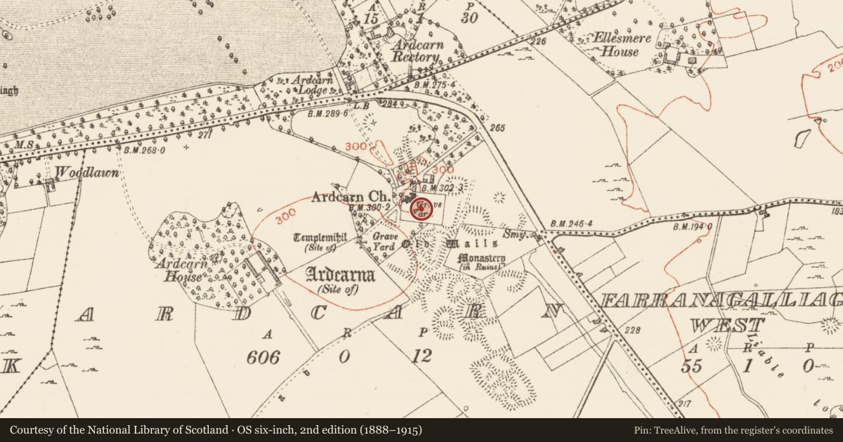
Slide toward Today to fade the historical sheet and see the modern map underneath.
David Rumsey Map Collection, Stanford LibrariesDavid Rumsey Map Collection, Stanford LibrariesDavid Rumsey Map Collection, Stanford LibrariesDavid Rumsey Map Collection, Stanford Libraries
4 historical maps cover this location, the earliest the 1790 map "Composite: Ireland." (David Rumsey Map Collection, Stanford Libraries).
Historical maps covering this location
- 1790 · Composite: Ireland. (David Rumsey Map Collection, Stanford Libraries)
- 1811 · Ireland. (David Rumsey Map Collection, Stanford Libraries)
- 1869 · Ireland. (David Rumsey Map Collection, Stanford Libraries)
- 1891 · Ireland 16 (David Rumsey Map Collection, Stanford Libraries)
This record in the National Monuments Service's Historic Environment Viewer ↗
The National Monuments Service's description
On the E-facing slope of Ardcarn Hill. Rectangular graveyard (dims 85m E-W; 60m N-S) on the site of the medieval parish church (RO006-103001-) defined by a mortared stone wall. A sandstone jam of a medieval doorway is used as a headstone as is a fragment of a window surround. A limestone memorial plaque erected by Cormac MacDermot, possibly a son of Owen Mac Conor Og of Aghacarra (Mac Dermot 1996, 360), in honour of his wife Elinor Crean in 1688 is situated just E of the present Church of Ireland church in the graveyard. There is a cross-inscribed stone (RO006-103019-) just S of the E end of the present church which was revamped in 1860 at the NW edge of the graveyard. A new graveyard (dims c. 100m NE-SW; c. 70m NW-SE) defined by masonry walls was built by 1914 and it contains the cross-inscribed stone (RO006-103006-) and a second cross-inscribed stone (RO006-103020-) identified by Mary B. Timoney in 2015. Archaeological supervision (14E0166) of the laying of a drain in the new graveyard produced no archaeological material (Timoney 2016).
Compiled by: Michael Moore
Date of upload: 24 August 2010
Amended: 17 April, 2014; 30 October 2020
References
Mac Dermot, D. 1996 Mac Dermot of Moylurg: the story of a Connacht family. Manorhamilton. Drumlin.
Timoney, M. A. 2016 Final report on limited work at Adcarn, Boyle, Co. Roscommon. Licence: 14E0166. Unpublished report, Author.
Nearby in the register
- Cross-inscribed stoneunder 1 mi
- Armorial plaqueunder 1 mi
- Churchunder 1 mi
- Settlement deserted - medievalunder 1 mi
Other entries of the same register within about three miles of this one, by straight line.