Sites and Monuments Record · Ireland
Ritual site - holy well
Termon, County Roscommon, Ireland
The record
- Townland
- Termon
- County
- Roscommon
- Country
- Ireland
- First-edition OS map
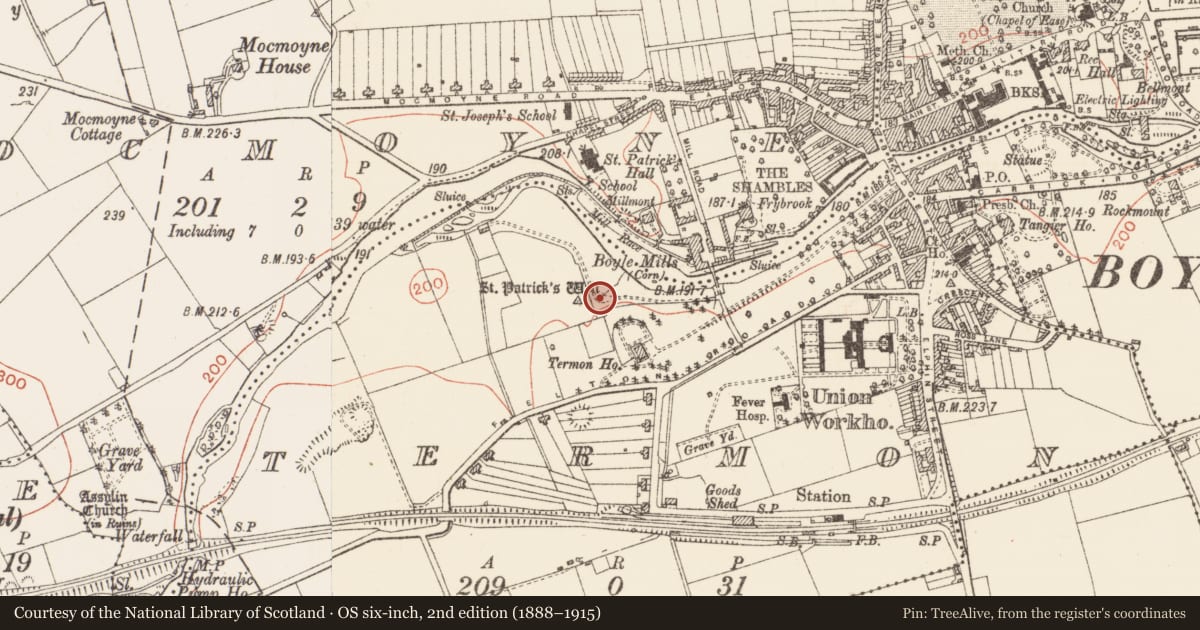
- St Patricks Well
- Latest-edition OS map
- St Patricks Well
- Coordinates
- 53.97041, -8.30963
- SMR number
- RO006-066001-
Slide toward Today to fade the historical sheet and see the modern map underneath.
David Rumsey Map Collection, Stanford LibrariesDavid Rumsey Map Collection, Stanford LibrariesDavid Rumsey Map Collection, Stanford LibrariesDavid Rumsey Map Collection, Stanford Libraries
4 historical maps cover this location, the earliest the 1790 map "Composite: Ireland." (David Rumsey Map Collection, Stanford Libraries).
Historical maps covering this location
- 1790 · Composite: Ireland. (David Rumsey Map Collection, Stanford Libraries)
- 1811 · Ireland. (David Rumsey Map Collection, Stanford Libraries)
- 1869 · Ireland. (David Rumsey Map Collection, Stanford Libraries)
- 1891 · Ireland 16 (David Rumsey Map Collection, Stanford Libraries)
This record in the National Monuments Service's Historic Environment Viewer ↗
The National Monuments Service's description
On flat ground at the bottom of a N-facing bluff (H c. 6m) and c. 50m from the SW bank of the NW-SE Boyle River where Ath Carpait, the ford of the chariot, may have been (FitzPatrick 1998, 354). A subcircular well (dims 1.4m NE-SW; c. 1m NW-SE) is covered by a D-shaped, masonry structure (ext. dims 2m NE-SW; 1.72m NW-SE) with a cement roof (max. H 1.05m) which is surmounted by a modern Latin cross. The well has a rectangular opening (Wth 0.65m; H 0.45m) to the NE, but there is no evidence of veneration. An oval piece of limestone (RO006-066002-) (dims 0.75m x 0.35m; H 0.3-0.4m) with two natural depressions on its upper surface is set in the ground 3.2m NE of the well and is regarded as having the knee-impressions of St Patrick. A stream runs off to the NE from the saint's stone.
Compiled by: Michael Moore
Date of upload: 24 August 2010
References
FitzPatrick, E. 1998 The inauguration of Tairdelbach Ó Concobhari at A(f)th an Termoinn. Peritia 12, 351-8.
Nearby in the register
- Ritual site - holy/saint's stoneunder 1 mi
- Ringfort - rathunder 1 mi
- Historic townunder 1 mi
- House - 18th/19th centuryunder 1 mi
Other entries of the same register within about three miles of this one, by straight line.