Sites and Monuments Record · Ireland
Architectural fragment
Kilteasheen, County Roscommon, Ireland
The record
- Townland
- Kilteasheen
- County
- Roscommon
- Country
- Ireland
- First-edition OS map
- Not indiated
- Latest-edition OS map
- Not indicated
- Coordinates
- 54.00120, -8.20143
- SMR number
- RO006-012003-
Slide toward Today to fade the historical sheet and see the modern map underneath.
David Rumsey Map Collection, Stanford LibrariesDavid Rumsey Map Collection, Stanford LibrariesDavid Rumsey Map Collection, Stanford LibrariesDavid Rumsey Map Collection, Stanford Libraries
4 historical maps cover this location, the earliest the 1790 map "Composite: Ireland." (David Rumsey Map Collection, Stanford Libraries).
Historical maps covering this location
- 1790 · Composite: Ireland. (David Rumsey Map Collection, Stanford Libraries)
- 1811 · Ireland. (David Rumsey Map Collection, Stanford Libraries)
- 1869 · Ireland. (David Rumsey Map Collection, Stanford Libraries)
- 1891 · Ireland 16 (David Rumsey Map Collection, Stanford Libraries)
This record in the National Monuments Service's Historic Environment Viewer ↗
The National Monuments Service's description
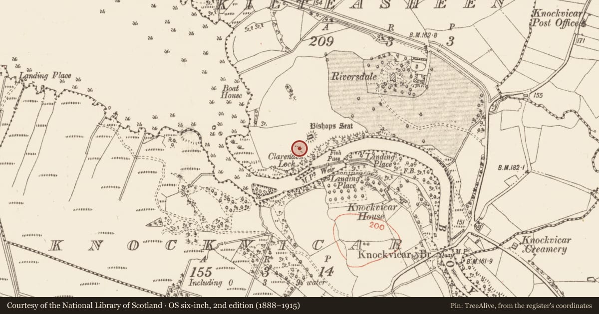
Situated on a rise on the N bank of the W-E Boyle river just as it leaves Lough Key and c. 30m SW of the Bishop's palace (RO006-013002-). Rubble from the wall of burial ground (RO006-012001-) which was probably spread in the 14th century included five decorated Romanesque stones, which may have been used as grave-markers. These can be dated to the 12th century and three came originally from a doorway, one from a window, and one from the string course of a church (Moss 2010, 131-7), which remains unlocated. The stones were recovered in excavation during 2005. (Read et al. 2005; Read 2009e, 460)
Compiled by: Michael Moore
Date of upload: 24 August 2010
References
Read, C. 2009e Kilteaseen: high medieval Gaelic lordly site. In I. Bennett (ed.), Excavations 2006: summary accounts of archaeological excavations in Ireland, 459-61, No. 1736. Dublin. Wordwell.
Moss, R. 2010 Romanesque sculpture in north Roscommon. In T. Finan (ed.), Medieval Lough Cé.119-144. Dublin. Four Courts Press.
Read, C., Finan, T. and Barton, K. 2005 Initial findings at Kilteasheen, Knockvicar, Co. Roscommon. Archaeology Ireland 19 (3), 18-20.
Nearby in the register
- Burial groundunder 1 mi
- Burialunder 1 mi
- Buildingunder 1 mi
- Kilnunder 1 mi
Other entries of the same register within about three miles of this one, by straight line.