Sites and Monuments Record · Ireland
Bawn
Ballyknockan (Clonlisk By.), County Offaly, Ireland
The record
- Townland
- Ballyknockan (Clonlisk By.)
- County
- Offaly
- Country
- Ireland
- First-edition OS map
- NULL
- Latest-edition OS map
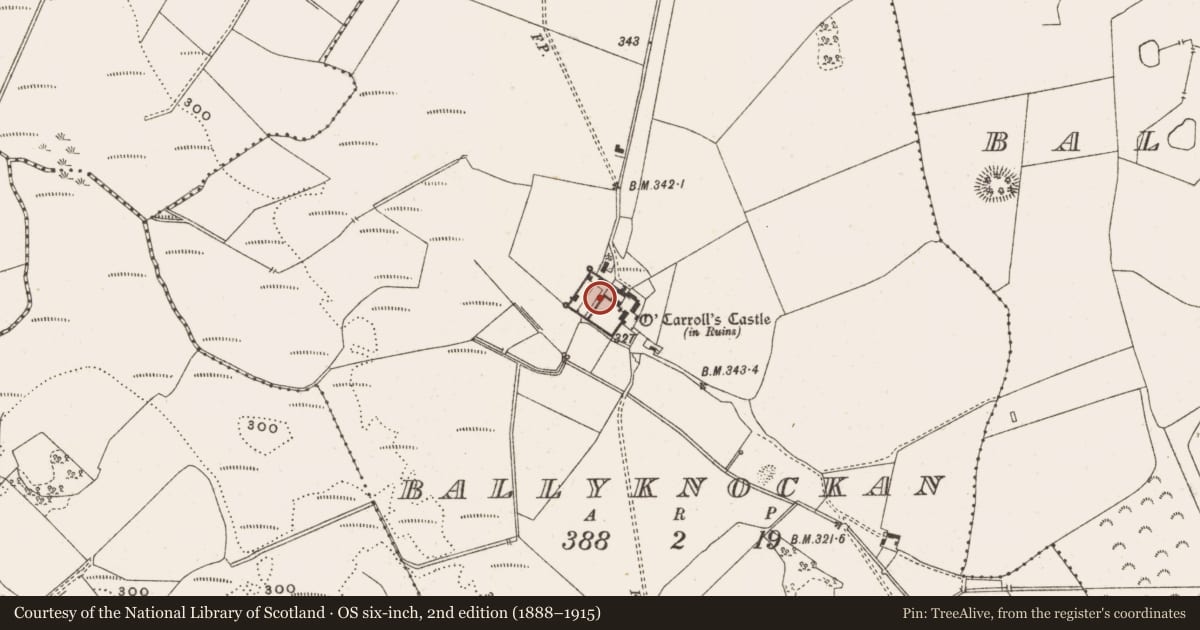
- OCarrolls Castle (in Ruins)
- Coordinates
- 53.00673, -7.84179
- SMR number
- OF042-010002-
Slide toward Today to fade the historical sheet and see the modern map underneath.
David Rumsey Map Collection, Stanford LibrariesDavid Rumsey Map Collection, Stanford LibrariesDavid Rumsey Map Collection, Stanford LibrariesDavid Rumsey Map Collection, Stanford Libraries
4 historical maps cover this location, the earliest the 1790 map "Composite: Ireland." (David Rumsey Map Collection, Stanford Libraries).
Historical maps covering this location
- 1790 · Composite: Ireland. (David Rumsey Map Collection, Stanford Libraries)
- 1811 · Ireland. (David Rumsey Map Collection, Stanford Libraries)
- 1869 · Ireland. (David Rumsey Map Collection, Stanford Libraries)
- 1891 · Ireland 16 (David Rumsey Map Collection, Stanford Libraries)
This record in the National Monuments Service's Historic Environment Viewer ↗
The National Monuments Service's description
Located in low-lying natural hollow in upland area. Only the W and S walls with portion of the N wall of bawn survives. Tower house (OF042-010001-) was located in NE corner of bawn where only a pile of rubble survives. Modern sheds abutted against the E side of the bawn. The bawn consists of a rectangular shaped area (int. dims. 56m N-S; 61m E-W approx.; wall T 0.7m) with two surviving circular angle towers at SW and NW angles. The angle towers (int. diam. 2.85m: wall T 0.8m) were two storeys high and accessed externally from the bawn area at each level similar to the angle towers at Kilcolgan castle (SMR 15:11). Evidence of gun loops were visible on both towers and bawn wall. The interior of the bawn was accessed through a large segmental arched entrance at the centre of the S wall. From the entrance a stone walled avenue (Wth 3m) running N-S divided the bawn into two areas. The tower house was located in the E half with the domestic quarters located in the W half. The remains of a small square house bonded to the N end of the W wall (int. dims. 4.6m by 4.6m; wall T 0.55m) is probably contemporary with the bawn and fortified house. Other outhouses of a later period are attached to the N wall of the bawn. All the surviving evidence points to a fortified house with large bawn wall with circular flanking towers erected in the 17th-century. Kilcolgan castle (SMR 15:11) in North Offaly is very similar to the above remains.
The above description is derived from the published 'Archaeological Inventory of County Offaly' (Dublin: Stationery Office, 1997). In certain instances the entries have been revised and updated in the light of recent research.
Date of upload: 23 May 2011
Nearby in the register
- Castle - tower houseunder 1 mi
- Ringfort - rathunder 1 mi
- Moated siteunder 1 mi
- Moated siteunder 1 mi
Other entries of the same register within about three miles of this one, by straight line.