Sites and Monuments Record · Ireland
Bawn
Leap, County Offaly, Ireland
The record
- Townland
- Leap
- County
- Offaly
- Country
- Ireland
- First-edition OS map
- NULL
- Latest-edition OS map
- Indicated
- Coordinates
- 53.02807, -7.80847
- SMR number
- OF039-047002-
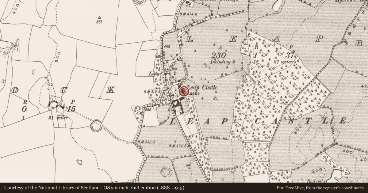
Slide toward Today to fade the historical sheet and see the modern map underneath.
David Rumsey Map Collection, Stanford LibrariesDavid Rumsey Map Collection, Stanford LibrariesDavid Rumsey Map Collection, Stanford LibrariesDavid Rumsey Map Collection, Stanford Libraries
4 historical maps cover this location, the earliest the 1790 map "Composite: Ireland." (David Rumsey Map Collection, Stanford Libraries).
Historical maps covering this location
- 1790 · Composite: Ireland. (David Rumsey Map Collection, Stanford Libraries)
- 1811 · Ireland. (David Rumsey Map Collection, Stanford Libraries)
- 1869 · Ireland. (David Rumsey Map Collection, Stanford Libraries)
- 1891 · Ireland 16 (David Rumsey Map Collection, Stanford Libraries)
This record in the National Monuments Service's Historic Environment Viewer ↗
The National Monuments Service's description
Located on the E facing slope of rising ground in upland area. Three storey high Tower house (OF039-047----) built with roughly coursed rubble with crenellated wall-walk. The W face of the tower has been heavily modified by the insertion of a Georgian door and facade with the interior of the building severely altered over the years. Originally the Tower house had a two ordered door on the S wall with chamfered stops, the top half of which is now missing and was defended by a machicolation at wall walk level. A later Georgian house was constructed around the core of the Jacobean house giving it its modern appearance today. Overall the tower house (OF039-047----) would appear to be a late 16th-century tower house with 17th-century house (OF039-047001-) to N with later Georgian alterations. O' Carroll castle captured by the English in 1557 and given to the Darby family in the 17th-century. Bawn area to S, W and N of castle with natural cliff edge on the E side. Bawn wall appears to have been greatly modified by the landscaping and rebuilding in the 18th century(Cooke 1875, 216-21).
Compiled by: Caimin O'Brien.
Date of upload: 23 May 2011
Nearby in the register
- House - 16th/17th centuryunder 1 mi
- Castle - tower houseunder 1 mi
- Enclosureunder 1 mi
- Enclosureunder 1 mi
Other entries of the same register within about three miles of this one, by straight line.