Sites and Monuments Record · Ireland
Church
Kilmochonna, County Offaly, Ireland
The record
- Townland
- Kilmochonna
- County
- Offaly
- Country
- Ireland
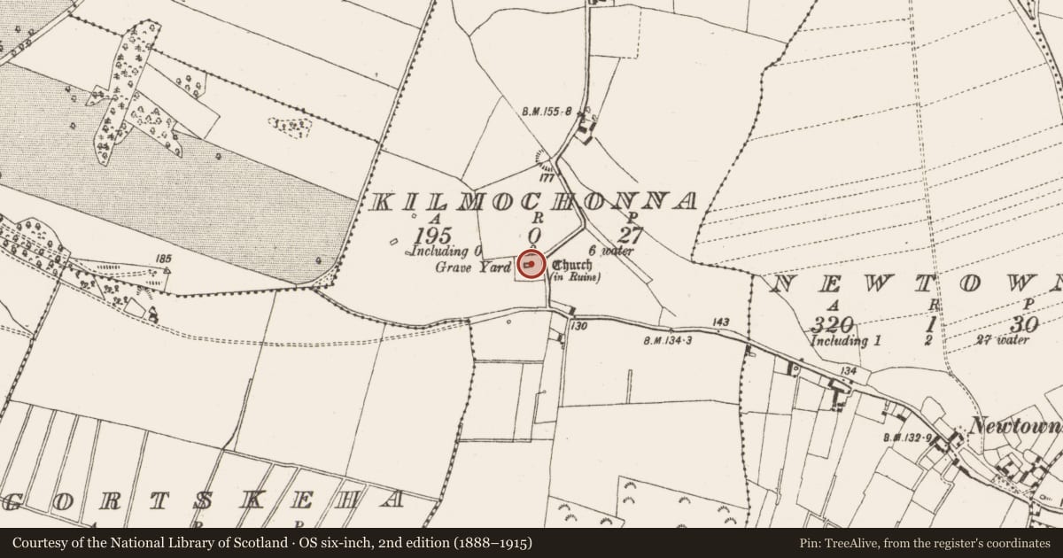
- Latest-edition OS map
- Church (in Ruins) Grave Yard
- Coordinates
- 53.15659, -8.02415
- SMR number
- OF029-012----
Slide toward Today to fade the historical sheet and see the modern map underneath.
David Rumsey Map Collection, Stanford LibrariesDavid Rumsey Map Collection, Stanford LibrariesDavid Rumsey Map Collection, Stanford LibrariesDavid Rumsey Map Collection, Stanford Libraries
4 historical maps cover this location, the earliest the 1790 map "Composite: Ireland." (David Rumsey Map Collection, Stanford Libraries).
Historical maps covering this location
- 1790 · Composite: Ireland. (David Rumsey Map Collection, Stanford Libraries)
- 1811 · Ireland. (David Rumsey Map Collection, Stanford Libraries)
- 1869 · Ireland. (David Rumsey Map Collection, Stanford Libraries)
- 1891 · Ireland 16 (David Rumsey Map Collection, Stanford Libraries)
This record in the National Monuments Service's Historic Environment Viewer ↗
The National Monuments Service's description
Situated on an E-W esker ridge with low-lying flat land to the S and undulating land to the N. In graveyard (OF029-012001-), much ruined rectangular church (dims. 13.1m E-W; 7.1m N-S; wall T 0.75m) with its S wall destroyed except for the SE portion. No architectural features evident on the N or W walls with a destroyed window in the E gable. The E splay of a window survives at the E end of the S wall. Wall niche visible at the S end of the E wall. The original doorway was located at the W end of the destroyed S wall. Several headstones have been erected in the interior of the church. The church walls are constructed with roughly coursed limestone rubble with evidence of a base batter on E gable only, with additional buttressing on the NE corner. The graveyard is enclosed by an almost square shaped wall which has recently been extended to the S for new burials, the graveyard contains 18/19th-century headstones.
The above description is derived from the published 'Archaeological Inventory of County Offaly' (Dublin: Stationery Office, 1997). In certain instances the entries have been revised and updated in the light of recent research.
Date of upload: 23 May 2011
Nearby in the register
- Graveyardunder 1 mi
- Burial groundunder 1 mi
- Burial moundunder 1 mi
- Castle - unclassifiedunder 1 mi
Other entries of the same register within about three miles of this one, by straight line.