Sites and Monuments Record · Ireland
Castle - unclassified
Kincora, County Offaly, Ireland
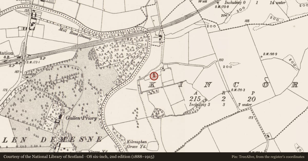
The record
- Townland
- Kincora
- County
- Offaly
- Country
- Ireland
- First-edition OS map
- Not indicated
- Latest-edition OS map
- Not indicated
- Coordinates
- 53.26664, -7.81751
- SMR number
- OF014-046----
Slide toward Today to fade the historical sheet and see the modern map underneath.
David Rumsey Map Collection, Stanford LibrariesDavid Rumsey Map Collection, Stanford LibrariesDavid Rumsey Map Collection, Stanford LibrariesDavid Rumsey Map Collection, Stanford Libraries
4 historical maps cover this location, the earliest the 1790 map "Composite: Ireland." (David Rumsey Map Collection, Stanford Libraries).
Historical maps covering this location
- 1790 · Composite: Ireland. (David Rumsey Map Collection, Stanford Libraries)
- 1811 · Ireland. (David Rumsey Map Collection, Stanford Libraries)
- 1869 · Ireland. (David Rumsey Map Collection, Stanford Libraries)
- 1891 · Ireland 16 (David Rumsey Map Collection, Stanford Libraries)
This record in the National Monuments Service's Historic Environment Viewer ↗
The National Monuments Service's description
Situated on a natural rise on the floodplains of the river Brosna. Not visible at ground level. Scattered and confused remains of a several 19th-century buildings with Demesne wall attached to the NW corner running in a S direction. The castle masonry was probably used in the building of the demesne wall and buildings. Evidence of this can be seen on the E side of the demesne wall where a window jamb with punch dressing is embedded in the wall. This piece of masonry came from the destroyed castle and indicates a late medieval date based on the fine punch dressing. This trend of knocking down a castle and reusing its rubble is very common in the county. The exact location of the castle is uncertain however the grass covered wall footings of a building to the W of the extant house may indicate the site of the destroyed castle.
The above description is derived from the published 'Archaeological Inventory of County Offaly' (Dublin: Stationery Office, 1997). In certain instances the entries have been revised and updated in the light of recent research.
Date of upload: 23 May 2011
Nearby in the register
- Enclosureunder 1 mi
- Churchunder 1 mi
- Wall monumentunder 1 mi
- Wall monumentunder 1 mi
Other entries of the same register within about three miles of this one, by straight line.