Sites and Monuments Record · Ireland
Cross-slab
Gallen, County Offaly, Ireland
The record
- Townland
- Gallen
- County
- Offaly
- Country
- Ireland
- Coordinates
- 53.26476, -7.82390
- SMR number
- OF014-029024-
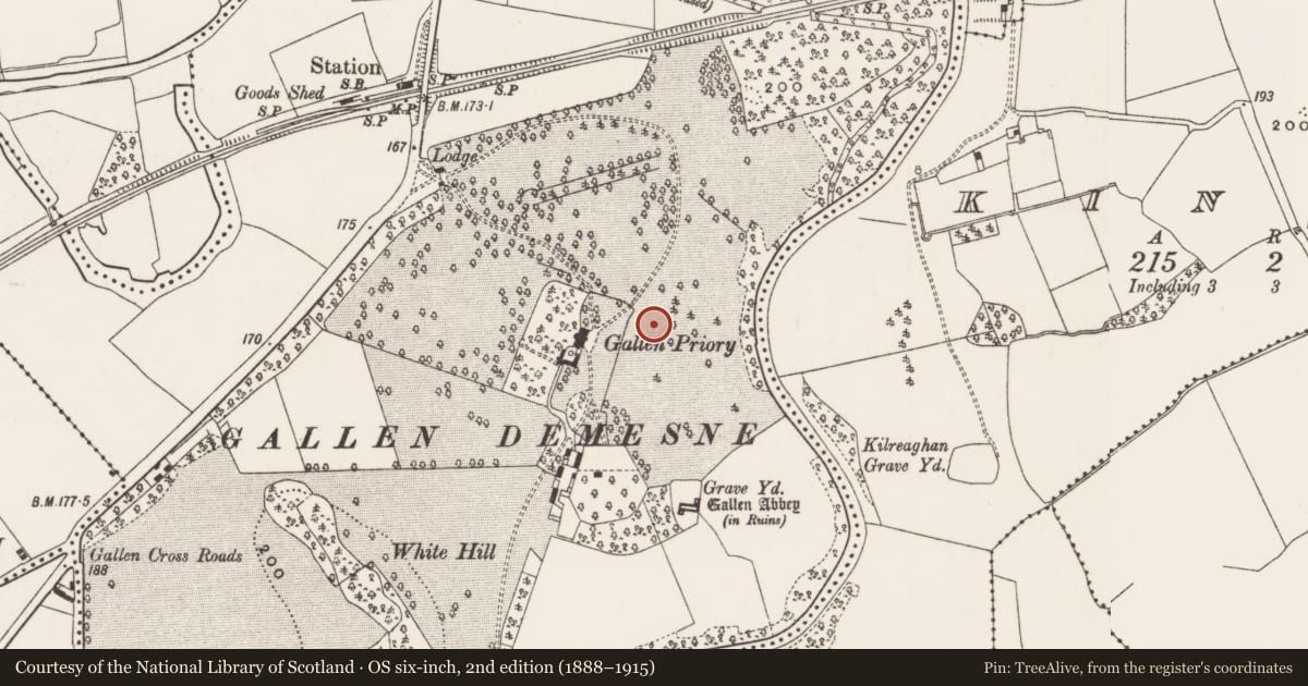
Slide toward Today to fade the historical sheet and see the modern map underneath.
David Rumsey Map Collection, Stanford LibrariesDavid Rumsey Map Collection, Stanford LibrariesDavid Rumsey Map Collection, Stanford LibrariesDavid Rumsey Map Collection, Stanford Libraries
4 historical maps cover this location, the earliest the 1790 map "Composite: Ireland." (David Rumsey Map Collection, Stanford Libraries).
Historical maps covering this location
- 1790 · Composite: Ireland. (David Rumsey Map Collection, Stanford Libraries)
- 1811 · Ireland. (David Rumsey Map Collection, Stanford Libraries)
- 1869 · Ireland. (David Rumsey Map Collection, Stanford Libraries)
- 1891 · Ireland 16 (David Rumsey Map Collection, Stanford Libraries)
This record in the National Monuments Service's Historic Environment Viewer ↗
The National Monuments Service's description
Sandstone cross-slab (dims. 0.19m x 0.17m x 0.04m) unearthed by Kendrick during his excavations in 1935 at Gallen priory. Described by Macalister as 'a cross pattée in a circle' (Macalister 1949, 75). This slab bears an inscription LENCM~ | NOTI, which can be expanded to LENC M[AC] NOTI (Macalister 1949, 75). According to Macalister `This [inscription] appears to be complete, except for a slight damage to the M: the names, however, may be abbreviated' (Macalister 1949, 75.
Reference
Macalister, R.A.S. 1949 75, Plate XXXV drawing concise discussion
Compiled by: Caimin O'Brien.
Date of upload: 23 May 2011
References
Macalister, R.A.S. 1949 Corpus Inscriptionum Insularum Celticarum, 2 vols. Dublin. Irish Manuscripts Commission.
Nearby in the register
- Churchunder 1 mi
- Cross-slabunder 1 mi
- Cross-slabunder 1 mi
- Cross-slabunder 1 mi
Other entries of the same register within about three miles of this one, by straight line.