Sites and Monuments Record · Ireland
Graveyard
Gallen, County Offaly, Ireland
The record
- Townland
- Gallen
- County
- Offaly
- Country
- Ireland
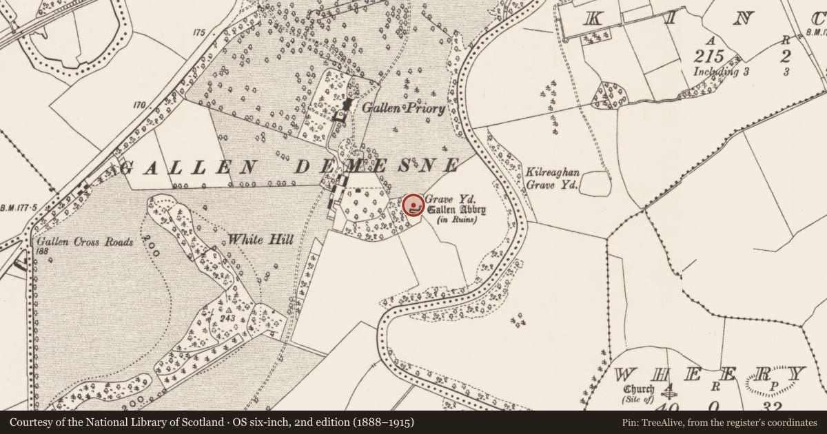
- First-edition OS map
- Grave Yard.
- Latest-edition OS map
- Grave Yd.
- Coordinates
- 53.26272, -7.82328
- SMR number
- OF014-029002-
Slide toward Today to fade the historical sheet and see the modern map underneath.
David Rumsey Map Collection, Stanford LibrariesDavid Rumsey Map Collection, Stanford LibrariesDavid Rumsey Map Collection, Stanford LibrariesDavid Rumsey Map Collection, Stanford Libraries
4 historical maps cover this location, the earliest the 1790 map "Composite: Ireland." (David Rumsey Map Collection, Stanford Libraries).
Historical maps covering this location
- 1790 · Composite: Ireland. (David Rumsey Map Collection, Stanford Libraries)
- 1811 · Ireland. (David Rumsey Map Collection, Stanford Libraries)
- 1869 · Ireland. (David Rumsey Map Collection, Stanford Libraries)
- 1891 · Ireland 16 (David Rumsey Map Collection, Stanford Libraries)
This record in the National Monuments Service's Historic Environment Viewer ↗
The National Monuments Service's description
Situated on a slight rise with river to the E. The ecclesiastical remains consist of a medieval church (OF014-029008-), possible abbey church (OF014-029001-), early Christian cross-slabs (OF014-029003-) and a bullaun stone (OF014-029005-). The Abbey which was built near the site of an Early Christian monastery founded by St. Canoc in 492 is now in a ruinous condition consisting of a long rectangular church built with roughly coursed limestone rubble with no architectural features evident. The interior of the abbey and sacristy are used as burial plots with a burial vault added to the W end of the S wall. There were several architectural fragments lying in the collapsed rubble along the walls of the church. A small graveyard was associated with the long rectangular church (OF014-029001-) which had a small rectangular sacristy attached to its NE corner. Most of the cross-slabs (OF014-029003-) which date from the 8th/11th-centuries (Harbison 1972, 206) came from this excavated area. 200 decorated slabs were discovered during this excavation and are described by Kendrick (1939 Vol. 69, 1-20). (Cooke 1875, 340-43; MacAlister 1908, 323-27; Crawford 1913, 362-5; Crawford 1918, 178; Fanning and O hEailidhe 1980, 17-19)
The above description is derived from the published 'Archaeological Inventory of County Offaly' (Dublin: Stationery Office, 1997). In certain instances the entries have been revised and updated in the light of recent research.
Date of upload: 23 May 2011
Nearby in the register
- Cross-slabunder 1 mi
- Ritual site - holy tree/bushunder 1 mi
- Religious house - Augustinian canonsunder 1 mi
- Cross-slabunder 1 mi
Other entries of the same register within about three miles of this one, by straight line.