Sites and Monuments Record · Ireland
Children's burial ground
Clonlyon Glebe, County Offaly, Ireland
The record
- Townland
- Clonlyon Glebe
- County
- Offaly
- Country
- Ireland
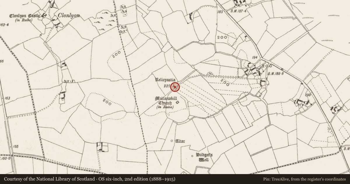
- First-edition OS map
- Relicpastia
- Latest-edition OS map
- Relicpastia
- Coordinates
- 53.28234, -7.88668
- SMR number
- OF014-016----
Slide toward Today to fade the historical sheet and see the modern map underneath.
David Rumsey Map Collection, Stanford LibrariesDavid Rumsey Map Collection, Stanford LibrariesDavid Rumsey Map Collection, Stanford LibrariesDavid Rumsey Map Collection, Stanford Libraries
4 historical maps cover this location, the earliest the 1790 map "Composite: Ireland." (David Rumsey Map Collection, Stanford Libraries).
Historical maps covering this location
- 1790 · Composite: Ireland. (David Rumsey Map Collection, Stanford Libraries)
- 1811 · Ireland. (David Rumsey Map Collection, Stanford Libraries)
- 1869 · Ireland. (David Rumsey Map Collection, Stanford Libraries)
- 1891 · Ireland 16 (David Rumsey Map Collection, Stanford Libraries)
This record in the National Monuments Service's Historic Environment Viewer ↗
The National Monuments Service's description
Situated on top of high ground with good extensive views with church (OF014-017001-) to SE. D-shaped graveyard enclosed by a stone wall (H 1m; W T 0.5m) which encloses an area (26m E-W; 15.5m N-S) with rows of erect unmarked headstones orientated E-W aligned on a N-S axis. Wall appears to be 18th/19th-century in date and possible coffin stand and stile located at the S end of the E wall. Graveyard may be associated with the nearby church which probably dates to the 18th-century. Uncertain if it is the site of a childrens burial ground, appears to be too elaborate for a childrens burial ground. May be associated with penal times thus explaining the unmarked headstones. May have been a graveyard that was reused asa childrens burial ground.
The above description is derived from the published 'Archaeological Inventory of County Offaly' (Dublin: Stationery Office, 1997). In certain instances the entries have been revised and updated in the light of recent research.
Date of upload: 23 May 2011
Nearby in the register
- Churchunder 1 mi
- Ecclesiastical enclosureunder 1 mi
- Altarunder 1 mi
- Enclosureunder 1 mi
Other entries of the same register within about three miles of this one, by straight line.