Sites and Monuments Record · Ireland
Inscribed stone
Croghan Demesne, County Offaly, Ireland
The record
- Townland
- Croghan Demesne
- County
- Offaly
- Country
- Ireland
- First-edition OS map
- NULL
- Latest-edition OS map
- Not indicated
- Coordinates
- 53.34152, -7.27555
- SMR number
- OF010-057001-
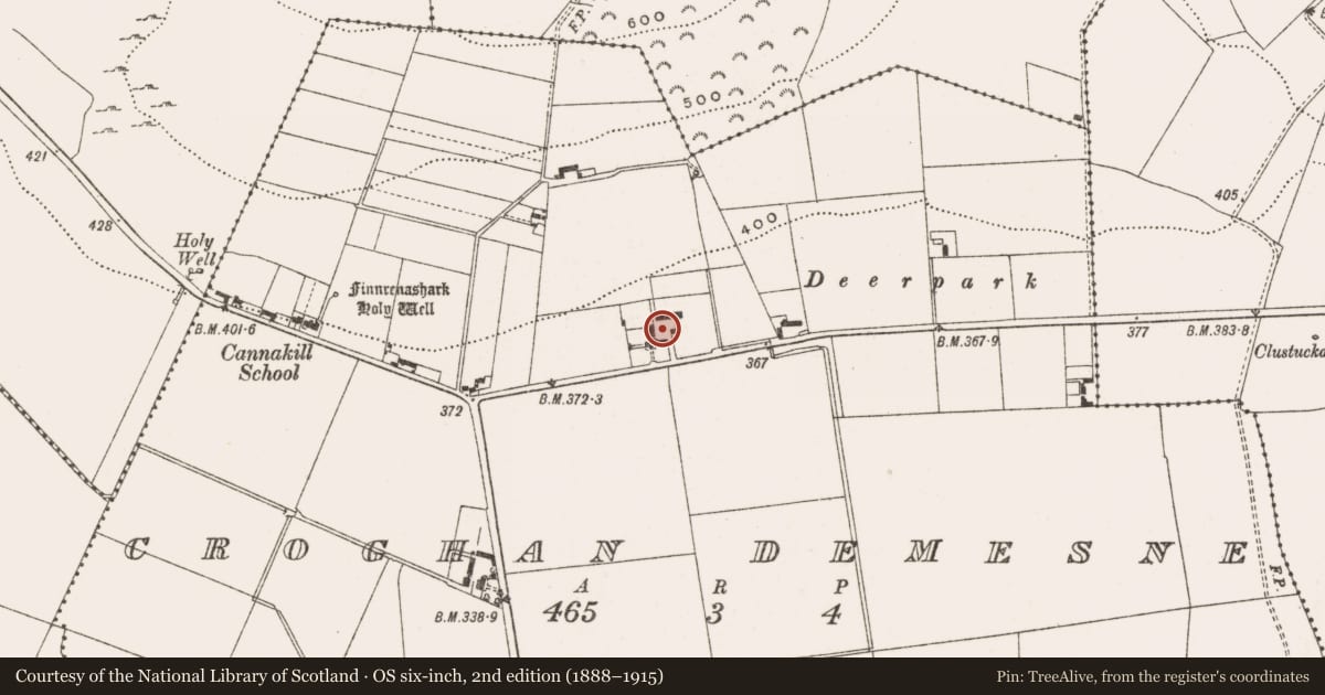
Slide toward Today to fade the historical sheet and see the modern map underneath.
David Rumsey Map Collection, Stanford LibrariesDavid Rumsey Map Collection, Stanford LibrariesDavid Rumsey Map Collection, Stanford LibrariesDavid Rumsey Map Collection, Stanford Libraries
4 historical maps cover this location, the earliest the 1790 map "Composite: Ireland." (David Rumsey Map Collection, Stanford Libraries).
Historical maps covering this location
- 1790 · Composite: Ireland. (David Rumsey Map Collection, Stanford Libraries)
- 1811 · Ireland. (David Rumsey Map Collection, Stanford Libraries)
- 1869 · Ireland. (David Rumsey Map Collection, Stanford Libraries)
- 1891 · Ireland 16 (David Rumsey Map Collection, Stanford Libraries)
This record in the National Monuments Service's Historic Environment Viewer ↗
The National Monuments Service's description
Finely carved head (OF010-057----) protruding from the external wall of an outhouse which is constructed from rubble of a medieval building of unknown origin or unknown location. The head has bulging eyes, a stiff mouth, prominent eyebrows with broken chin. The top of the head is flat suggesting possible use as a corbel. To the right of the head on the wall there is a wall plaque with inscription which reads TM 1681. Outhouse is possibly built on the site of a castle owned by George Moore in 1598, the rubble of which was incorporated into the outhouse.
Late medieval limestone head set into farmyard wall. Appears to have chain-mail. Walls also contain late-medieval cut stone and a plaque with date of 1681 and initials J.M. (OF010-057001-).
The above description is derived from the published 'Archaeological Inventory of County Offaly' (Dublin: Stationery Office, 1997). In certain instances the entries have been revised and updated in the light of recent research.
Date of upload: 23 May 2011
Nearby in the register
- Stone headunder 1 mi
- Ritual site - holy wellunder 1 mi
- Burial groundunder 1 mi
- Graveslabunder 1 mi
Other entries of the same register within about three miles of this one, by straight line.