Sites and Monuments Record · Ireland
Bullaun stone
Castletown (Ballycowan By.), County Offaly, Ireland
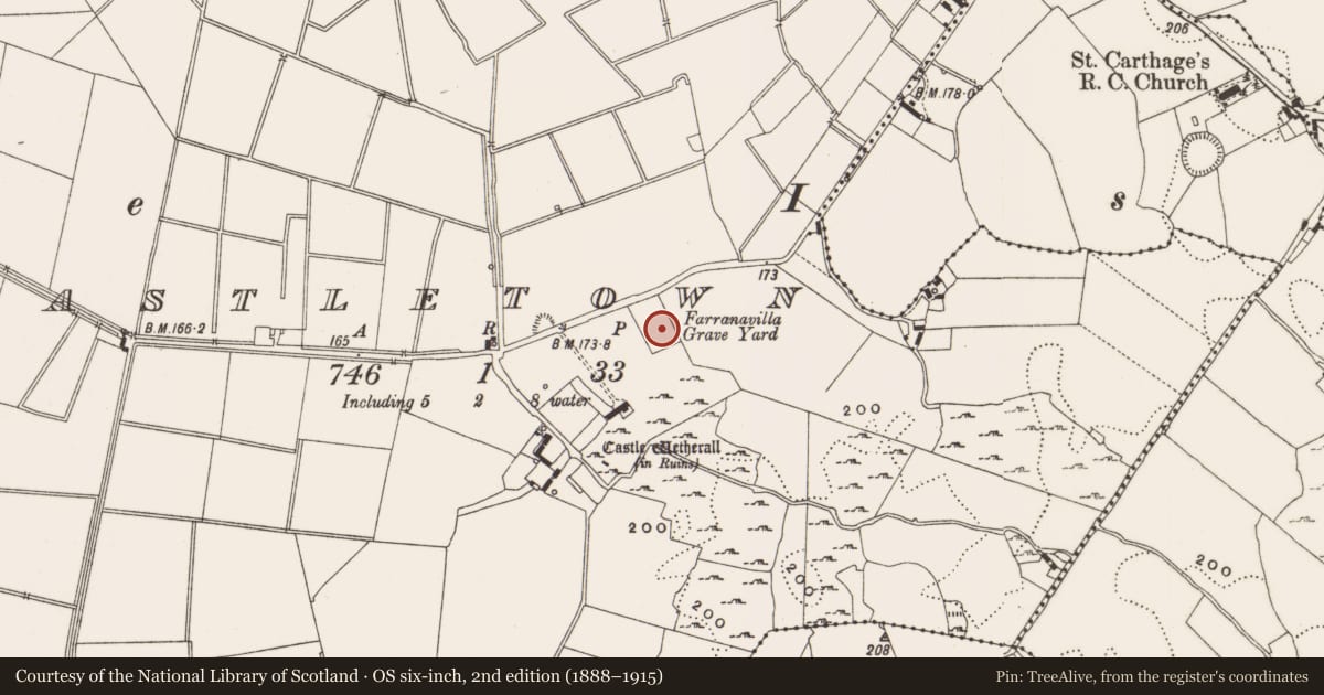
The record
- Townland
- Castletown (Ballycowan By.)
- County
- Offaly
- Country
- Ireland
- Latest-edition OS map
- Not indicated
- Coordinates
- 53.30847, -7.67558
- SMR number
- OF007-052002-
Slide toward Today to fade the historical sheet and see the modern map underneath.
David Rumsey Map Collection, Stanford LibrariesDavid Rumsey Map Collection, Stanford LibrariesDavid Rumsey Map Collection, Stanford LibrariesDavid Rumsey Map Collection, Stanford Libraries
4 historical maps cover this location, the earliest the 1790 map "Composite: Ireland." (David Rumsey Map Collection, Stanford Libraries).
Historical maps covering this location
- 1790 · Composite: Ireland. (David Rumsey Map Collection, Stanford Libraries)
- 1811 · Ireland. (David Rumsey Map Collection, Stanford Libraries)
- 1869 · Ireland. (David Rumsey Map Collection, Stanford Libraries)
- 1891 · Ireland 16 (David Rumsey Map Collection, Stanford Libraries)
This record in the National Monuments Service's Historic Environment Viewer ↗
The National Monuments Service's description
Situated on a slight rise in undulating countryside. A large irregularly shaped graveyard (OF007-051) enclosed by a drystone wall with 19th-century headstones concentrated in its S sector. A small rectangular drystone-walled enclosure to the SE may represent a single family burial plot. Two bullaun stones (OF007-052001/002-) are located in a pile of field clearance stones to the N of the headstones. A chamfered and rebated jambstone of a late medieval limestone window can be seen lying on the ground immediately N of the headstones. This fragment may have come from the nearby castle ruins (OF007-051) located in the field to the SW of the graveyard.
Compiled by: Caimin O'Brien.
Date of upload: 23 May 2011
Nearby in the register
- Bullaun stoneunder 1 mi
- Architectural fragmentunder 1 mi
- Burial groundunder 1 mi
- Bawnunder 1 mi
Other entries of the same register within about three miles of this one, by straight line.