Sites and Monuments Record · Ireland
Church
Clonmacnoise, County Offaly, Ireland
The record
- Townland
- Clonmacnoise
- County
- Offaly
- Country
- Ireland
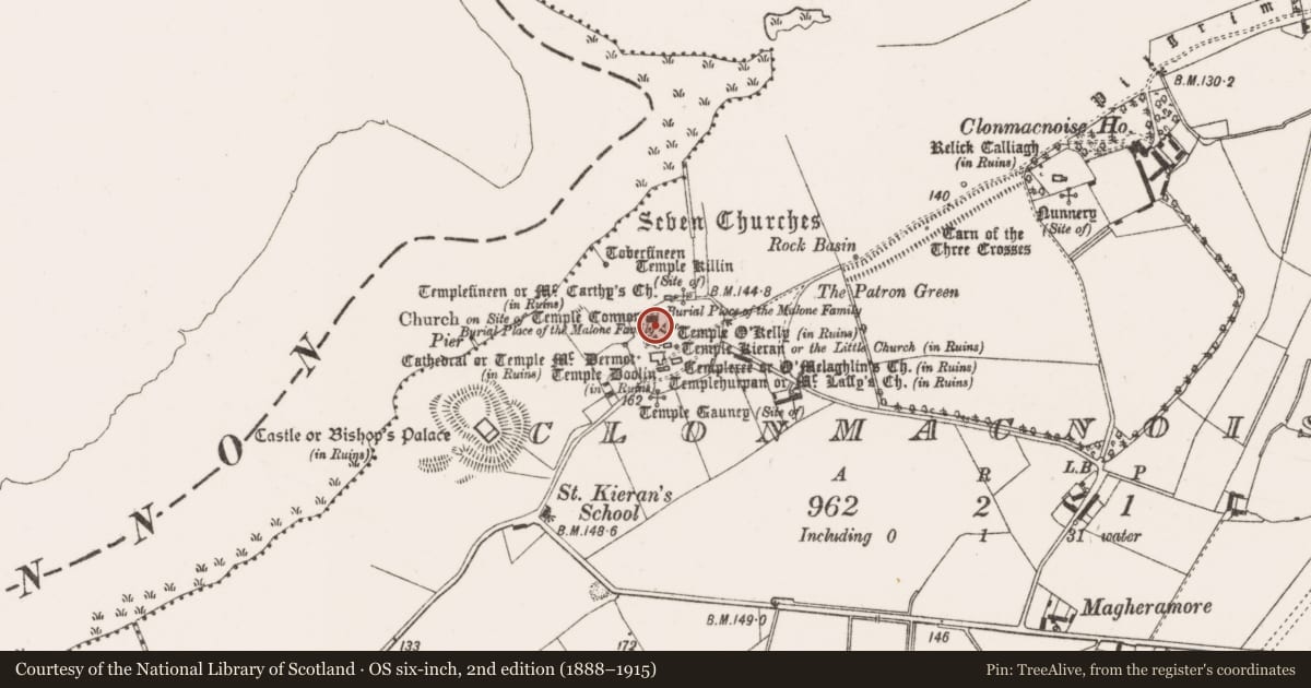
- Latest-edition OS map
- Temple Conor
- Coordinates
- 53.32675, -7.98610
- SMR number
- OF005-005----
Slide toward Today to fade the historical sheet and see the modern map underneath.
David Rumsey Map Collection, Stanford LibrariesDavid Rumsey Map Collection, Stanford LibrariesDavid Rumsey Map Collection, Stanford LibrariesDavid Rumsey Map Collection, Stanford Libraries
4 historical maps cover this location, the earliest the 1790 map "Composite: Ireland." (David Rumsey Map Collection, Stanford Libraries).
Historical maps covering this location
- 1790 · Composite: Ireland. (David Rumsey Map Collection, Stanford Libraries)
- 1811 · Ireland. (David Rumsey Map Collection, Stanford Libraries)
- 1869 · Ireland. (David Rumsey Map Collection, Stanford Libraries)
- 1891 · Ireland 16 (David Rumsey Map Collection, Stanford Libraries)
This record in the National Monuments Service's Historic Environment Viewer ↗
The National Monuments Service's description
National Monument No. 81. Present remains consist of a heavily modified church (8.2m N-S; 13.3m E-W; wall T 1.2m) which is used as a modern place of worship. The church has retained its original W doorway in Romanesque style with single order and moulded capitals. The only other original feature is a small round headed window at the E end of the S wall. All the other architectural features belong to the 19th century restoration of the church. There is a large burial enclosure to the Malone family adjoining the N wall at the E end. Window at the E end of the N wall now blocked by Malone burial vaults. (O' Donovan 1856-7, 447; Anon 1868-9, 141-7; Monahan 1886, 68; Anon 1907, 335; Westropp 1907; 297; Macalister 1910, 24; O'Flanagan 1933, vol. 1, 66; Molloy 1950, 11; Harbison 1972, 204; Manning 1994, 29)
The above description is derived from the published 'Archaeological Inventory of County Offaly' (Dublin: Stationery Office, 1997). In certain instances the entries have been revised and updated in the light of recent research.
Date of upload: 23 May 2011
Nearby in the register
- Cross - High crossunder 1 mi
- Bullaun stoneunder 1 mi
- Churchunder 1 mi
- Churchunder 1 mi
Other entries of the same register within about three miles of this one, by straight line.