Sites and Monuments Record · Ireland
Mound
Ballykilleen (Kilcoursey By.), County Offaly, Ireland
The record
- Townland
- Ballykilleen (Kilcoursey By.)
- County
- Offaly
- Country
- Ireland
- First-edition OS map
- Indicated
- Latest-edition OS map
- Indicated
- Coordinates
- 53.38241, -7.61063
- SMR number
- OF002-020----
Slide toward Today to fade the historical sheet and see the modern map underneath.
David Rumsey Map Collection, Stanford LibrariesDavid Rumsey Map Collection, Stanford LibrariesDavid Rumsey Map Collection, Stanford LibrariesDavid Rumsey Map Collection, Stanford Libraries
4 historical maps cover this location, the earliest the 1790 map "Composite: Ireland." (David Rumsey Map Collection, Stanford Libraries).
Historical maps covering this location
- 1790 · Composite: Ireland. (David Rumsey Map Collection, Stanford Libraries)
- 1811 · Ireland. (David Rumsey Map Collection, Stanford Libraries)
- 1869 · Ireland. (David Rumsey Map Collection, Stanford Libraries)
- 1891 · Ireland 16 (David Rumsey Map Collection, Stanford Libraries)
This record in the National Monuments Service's Historic Environment Viewer ↗
The National Monuments Service's description
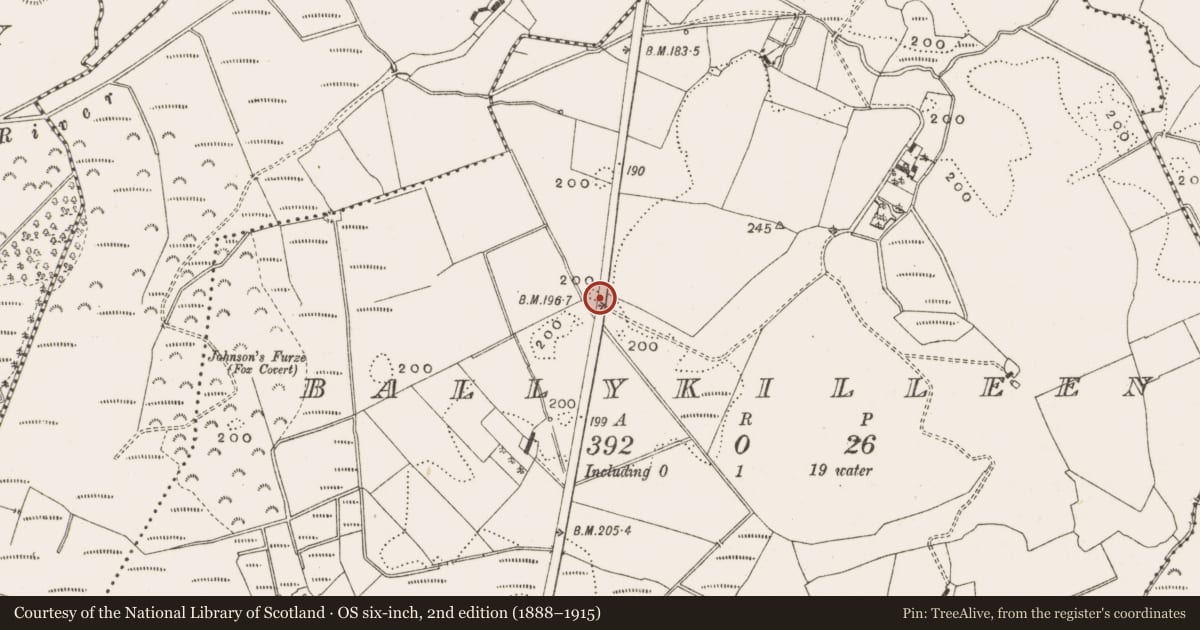
Site of a natural mound which appears to be of no archaeological significance. Described in 1977 as, 'A natural mound?, This is a low rounded mound. The roadway cuts away part of the mound on the eastern side. The southern end of the mound has been scarped and a number of bushes growing along the perimeter. This does not resemble an antiquity and it appears to be a natural mound', (ASI file 1977). Depicted on the 1838 edition of the OS 6-inch map not as an antiquity, but as an irregular shaped earthwork or enclosure intersected by a field boundary on the W side running NW-SE. Depicted as a small natural hillock defined by a 200 ft contour line on the revised 1908 edition of the OS 6-inch map. Of doubtful antiquity.
The above description is derived from the published 'Archaeological Inventory of County Offaly' (Dublin: Stationery Office, 1997). In certain instances the entries have been revised and updated in the light of recent research.
Compiled by Caimin O'Brien
Date of upload/revision: 19 December 2011
Nearby in the register
- Water mill - horizontal-wheeledunder 1 mi
- Burnt spreadunder 1 mi
- Burnt spreadunder 1 mi
- Burnt spreadunder 1 mi
Other entries of the same register within about three miles of this one, by straight line.