Sites and Monuments Record · Ireland
Graveyard
Onomy, County Monaghan, Ireland
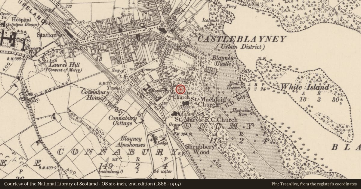
The record
- Townland
- Onomy
- County
- Monaghan
- Country
- Ireland
- First-edition OS map
- Not indicated
- Latest-edition OS map
- Grave Yd.
- Coordinates
- 54.11790, -6.73267
- SMR number
- MO020-027001-
Slide toward Today to fade the historical sheet and see the modern map underneath.
David Rumsey Map Collection, Stanford LibrariesDavid Rumsey Map Collection, Stanford LibrariesDavid Rumsey Map Collection, Stanford LibrariesDavid Rumsey Map Collection, Stanford Libraries
4 historical maps cover this location, the earliest the 1636 map "Vltoniae Orientalis Pars" (David Rumsey Map Collection, Stanford Libraries).
Historical maps covering this location
- 1636 · Vltoniae Orientalis Pars (David Rumsey Map Collection, Stanford Libraries)
- 1790 · Composite: Ireland. (David Rumsey Map Collection, Stanford Libraries)
- 1811 · Ireland. (David Rumsey Map Collection, Stanford Libraries)
- 1891 · Ireland 16 (David Rumsey Map Collection, Stanford Libraries)
This record in the National Monuments Service's Historic Environment Viewer ↗
The National Monuments Service's description
Located on a shelf that slopes down gently to the N with slightly lower ground to the W before a hill rises over the town of Castleblayney, but the ground falls away steeply to the N and E. The parochial centre of Muckno parish moved from the site of St Maodóid’s monastery and the medieval parish church at Church Hill (MO020-020001-), on the E shore of Lough Muckno, to Castleblayney during the seventeenth century. William, the sixth Lord Blayney probably built the church (MO020-027----) at the N end of a subrectangular graveyard (dims c. 170m NNW-SSE; c. 60m ENE-WSW) defined by masonry walls. The oldest memorials dating from c. 1770 are around this structure on a slightly rising area (diam. c. 45m), forming the original graveyard. The present Church of Ireland church of St Maeldoid which was built in 1858-60 is a replacement for a church on the same site at the centre of the graveyard that was built in 1810 (Lewis 1837 vol. 2, 408)
Compiled by: Caimin O'Brien
Revised by: Michael Moore
Date of revised upload: 22 June 2017
References
Lewis, S. 1837 A topographical dictionary of Ireland, 2 vols. London. Lewis and Co.
Nearby in the register
- Churchunder 1 mi
- Bawnunder 1 mi
- House - fortified houseunder 1 mi
- Enclosureunder 1 mi
Other entries of the same register within about three miles of this one, by straight line.