Sites and Monuments Record · Ireland
Ringfort - rath
Anneville Or Clonard Old, County Meath, Ireland
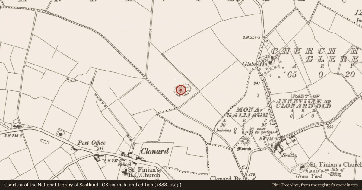
The record
- Townland
- Anneville Or Clonard Old
- County
- Meath
- Country
- Ireland
- First-edition OS map
- Not indicated
- Latest-edition OS map
- Hachured
- Coordinates
- 53.45392, -7.01545
- SMR number
- ME047-003----
Slide toward Today to fade the historical sheet and see the modern map underneath.
David Rumsey Map Collection, Stanford LibrariesDavid Rumsey Map Collection, Stanford LibrariesDavid Rumsey Map Collection, Stanford LibrariesDavid Rumsey Map Collection, Stanford Libraries
4 historical maps cover this location, the earliest the 1790 map "Composite: Ireland." (David Rumsey Map Collection, Stanford Libraries).
Historical maps covering this location
- 1790 · Composite: Ireland. (David Rumsey Map Collection, Stanford Libraries)
- 1799 · Ireland. (David Rumsey Map Collection, Stanford Libraries)
- 1869 · Ireland. (David Rumsey Map Collection, Stanford Libraries)
- 1891 · Ireland 16 (David Rumsey Map Collection, Stanford Libraries)
This record in the National Monuments Service's Historic Environment Viewer ↗
The National Monuments Service's description
Situated on a hillock in a level landscape with the canalised NW-SE Clonard stream c. 50m to the SW at the closest point. This is an oval grass-covered platform (dims of top 38m E-W; 21m N-S) defined by a scarp (Wth 5m; H 1.4m at E to 2.2m at W) with a berm (Wth 5m at E to c. 18m at W) at the base that is defined by a scarp (Wth 3m; H 0.8-1.1m) marking the bottom of the hillock. There is a wide entrance (Wth of base 4m) at SE. Rath (ME047-002----) is immediately to the W. Archaeological testing (04E1623) by S. Turrell c. 140m to the S on the other side of the river in Towlagh townland produced no related material (excavations.ie 2004:1358).
The above description is derived from the published 'Archaeological Inventory of County Meath' (Dublin: Stationery Office, 1987). In certain instances the entries have been revised and updated in the light of recent research.
Compiled by: Michael Moore
Date of revision: 13 August 2019
Amended: 14 July 2021, 24 March 2023
Nearby in the register
- Ringfort - rathunder 1 mi
- Excavation - miscellaneousunder 1 mi
- Castle - motteunder 1 mi
- Castle - ringworkunder 1 mi
Other entries of the same register within about three miles of this one, by straight line.