Sites and Monuments Record · Ireland
Kiln
Dunshaughlin, County Meath, Ireland
The record
- Townland
- Dunshaughlin
- County
- Meath
- Country
- Ireland
- First-edition OS map
- Not indicated
- Latest-edition OS map
- Not indicated
- Coordinates
- 53.50720, -6.53248
- SMR number
- ME044-063----
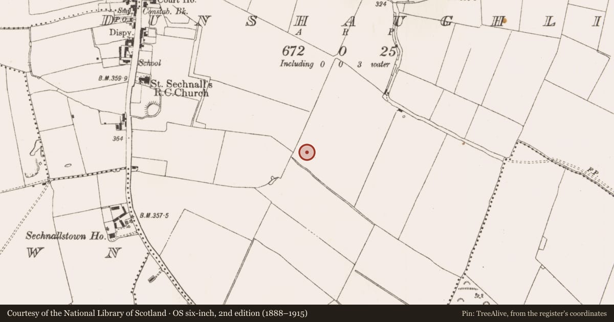
Slide toward Today to fade the historical sheet and see the modern map underneath.
David Rumsey Map Collection, Stanford LibrariesDavid Rumsey Map Collection, Stanford LibrariesDavid Rumsey Map Collection, Stanford LibrariesDavid Rumsey Map Collection, Stanford Libraries
4 historical maps cover this location, the earliest the 1799 map "Ireland." (David Rumsey Map Collection, Stanford Libraries).
Historical maps covering this location
- 1799 · Ireland. (David Rumsey Map Collection, Stanford Libraries)
- 1811 · Ireland. (David Rumsey Map Collection, Stanford Libraries)
- 1830 · V.3:11-15:XV. Britisches Reich. C. Kon: Ireland. a. Prov: Leinster. Counties: 1-12 (David Rumsey Map Collection, Stanford Libraries)
- 1891 · Ireland 16 (David Rumsey Map Collection, Stanford Libraries)
This record in the National Monuments Service's Historic Environment Viewer ↗
The National Monuments Service's description
Situated on a slight S-facing slope. A remote sensing survey (18R0012) by J. Nicholls (2018) identified numerous potential archaeological features and archaeological testing (18E0495) by L. Kavanagh (Kavanagh and Tobin 2018) confirmed the presence of three isolated pits, two burnt mounds and a ring-ditch (excavations.ie 2018:226). The features were subsequently excavated by M. Piera under the same licence (excavations.ie 2019:735).
A figure-of-eight kiln (dims 2.2m N-S; 0.8m E-W; max. D 0.4m) that had a combustion chamber with a fire-reddened base at N and a drying chamber at S was 7m N of a keyhole-shaped kiln (dims 1.6m x 0.8m; D 0.25m) with its flue extending N. Both were filled with silty clays with frequent charcoal and burnt clay inclusions. A subrectangular pit (dims 1.2m x 0.6m; D 0.16m) with a fire-reddened base that could be another kiln was 8m to the SW of the figure-of- eight kiln, and a small fire-spot (diam. 0.3m; D 0.06m) was 4m to the SE. (Piera 2020, 22-3)
Compiled by: Michael Moore
Date of upload: 10 December 2021
References
Piera, M. 2020 Preliminary Excavation Report for The Willows, Dunshaughlin, Co. Meath. Licence: 18E0495. Unpublished report, Irish Archaeological Consultancy
Nicholls, J. 2018 Phases 1C, 1D, 2 &3, The Willows, Dublin Road, Dunshaughlin, Co. Meath. Licence: 18R0012. Unpublished report, Target Archaeological Geophysics (TAG1800IE2)
Kavanagh, L. and Tobin, M. 2018 Archaeological assessment at The Willows, Dunshaughlin, Co. Meath. Licence No. 18E0495. Unpublished excavation, IAC
Nearby in the register
- Burnt moundunder 1 mi
- Kilnunder 1 mi
- Ring-ditchunder 1 mi
- Fulacht fiaunder 1 mi
Other entries of the same register within about three miles of this one, by straight line.