Sites and Monuments Record · Ireland
Ring-ditch
Ratoath, County Meath, Ireland
The record
- Townland
- Ratoath
- County
- Meath
- Country
- Ireland
- First-edition OS map
- Not indicated
- Latest-edition OS map
- Not indicated
- Coordinates
- 53.50972, -6.47089
- SMR number
- ME044-044004-
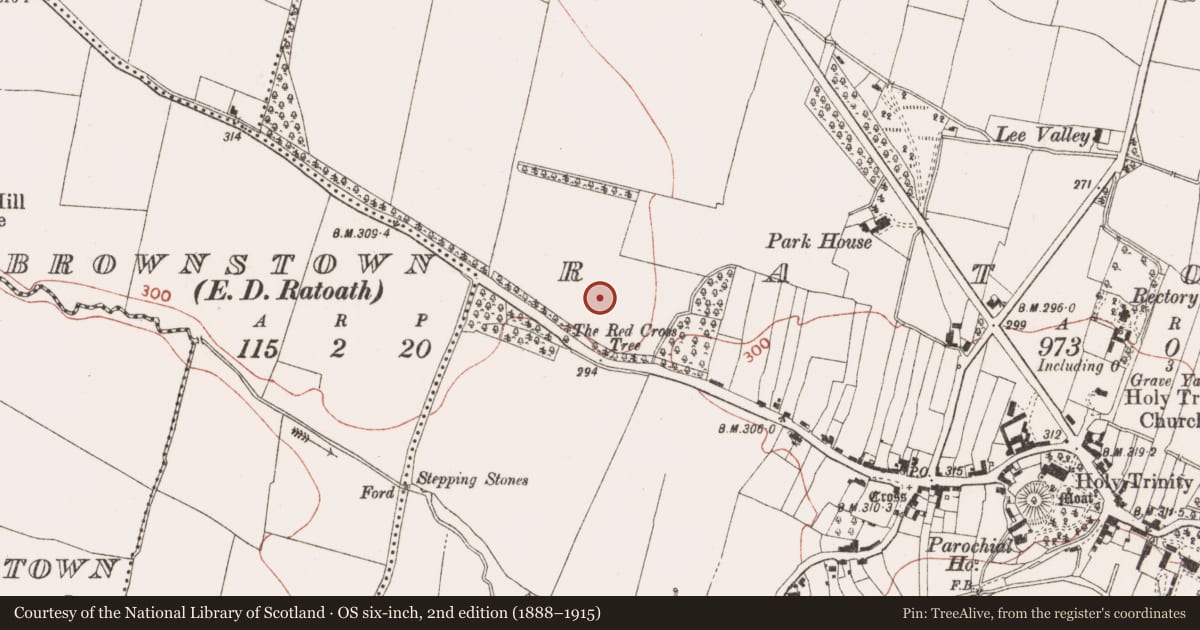
Slide toward Today to fade the historical sheet and see the modern map underneath.
David Rumsey Map Collection, Stanford LibrariesDavid Rumsey Map Collection, Stanford LibrariesDavid Rumsey Map Collection, Stanford LibrariesDavid Rumsey Map Collection, Stanford Libraries
4 historical maps cover this location, the earliest the 1799 map "Ireland." (David Rumsey Map Collection, Stanford Libraries).
Historical maps covering this location
- 1799 · Ireland. (David Rumsey Map Collection, Stanford Libraries)
- 1811 · Ireland. (David Rumsey Map Collection, Stanford Libraries)
- 1830 · V.3:11-15:XV. Britisches Reich. C. Kon: Ireland. a. Prov: Leinster. Counties: 1-12 (David Rumsey Map Collection, Stanford Libraries)
- 1891 · Ireland 16 (David Rumsey Map Collection, Stanford Libraries)
This record in the National Monuments Service's Historic Environment Viewer ↗
The National Monuments Service's description
Located towards the bottom of the SE-facing slope of NW-SE spur. Archaeological monitoring (03E1300) identified numerous features in this area including this ring-ditch which was fully excavated (03E1781). It is a subrectangular feature (dims c. 8m N-S; 6m E-W) defined by a continuous narrow fosse or gully. No artefacts were recovered from it but it was cut by a wide drain from the field system (ME044-044006-). It is located c. 5m N of the circular ring-ditch (ME044-044005-) and c. 80m SE of the burial ground (ME044-044003-). (Wallace 2003, 2006b)
References
Wallace, A. 2006b 1454. Licence: 03E1781. Ratoath: Two ring-ditches, burnt pits, kilns, possible field system. In I. Bennett (ed.) Excavations 2003: summary accounts of archaeological excavations in Ireland, 387-8. Bray, Wordwell
Wallace, A. 2006a 1452. Licence: 03E1300. Ratoath: Burnt spread, ring-ditch, possible field system and cemetery enclosure. In I. Bennett (ed.) Excavations 2003: summary accounts of archaeological excavations in Ireland, 386-7. Bray, Wordwell
Nearby in the register
- Ring-ditchunder 1 mi
- Field systemunder 1 mi
- Burial groundunder 1 mi
- Ring-ditchunder 1 mi
Other entries of the same register within about three miles of this one, by straight line.