Sites and Monuments Record · Ireland
Ritual site - holy well
Culmullin, County Meath, Ireland
The record
- Townland
- Culmullin
- County
- Meath
- Country
- Ireland
- First-edition OS map
- Not indicated
- Latest-edition OS map
- St Nicholas Well
- Coordinates
- 53.48671, -6.61192
- SMR number
- ME043-045----
Slide toward Today to fade the historical sheet and see the modern map underneath.
David Rumsey Map Collection, Stanford LibrariesDavid Rumsey Map Collection, Stanford LibrariesDavid Rumsey Map Collection, Stanford LibrariesDavid Rumsey Map Collection, Stanford Libraries
4 historical maps cover this location, the earliest the 1790 map "Composite: Ireland." (David Rumsey Map Collection, Stanford Libraries).
Historical maps covering this location
- 1790 · Composite: Ireland. (David Rumsey Map Collection, Stanford Libraries)
- 1799 · Ireland. (David Rumsey Map Collection, Stanford Libraries)
- 1830 · V.3:11-15:XV. Britisches Reich. C. Kon: Ireland. a. Prov: Leinster. Counties: 1-12 (David Rumsey Map Collection, Stanford Libraries)
- 1891 · Ireland 16 (David Rumsey Map Collection, Stanford Libraries)
This record in the National Monuments Service's Historic Environment Viewer ↗
The National Monuments Service's description
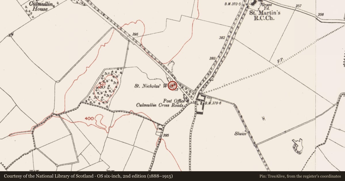
Situated at the bottom of an E-facing slope with a NW-SE road just to the NE. The well is only depicted on the 1912 edition of the OS 6-inch map where it is described in italic script as ‘St. Nicholas’ Well’. Cogan (1867, 2, 351) regarded it as a holy well ‘eight feet six inches in diameter (c. 2.5m)’, and it was then accessed by a stile from the road which was decorated with a cross and the name ‘St. Nicholas’s Well’. In the 1930s (IFC Schools Collection, vol. 689, 121) it was described as having flagstones around it inside a picket fence, and while there was no pattern it had a cure for headaches. Today there is a hollow (diam. of top 4m; diam. of base 2.5m; max. D 0.8m) occupied by a pump-house accessed directly from the road. (French 2012, 72-3)
Compiled by: Michael Moore
Date of upload: 26 August 2019
References
French, N. 2012 Meath Holy Wells. Meath Heritage Centre
IFC Schools' MSS: Irish Folklore Commission Schools' Manuscripts. Department of Folklore. University College, Dublin.
Cogan, Rev. A. 1862-70 Ecclesiastical history of the diocese of Meath: ancient and modern. (3 vols) Dublin: John Fowler, Joseph Dollard
Nearby in the register
- Font (present location)under 1 mi
- Stoup (present location)under 1 mi
- Castle - motteunder 1 mi
- Buildingunder 1 mi
Other entries of the same register within about three miles of this one, by straight line.