Sites and Monuments Record · Ireland
Church
Killyon, County Meath, Ireland
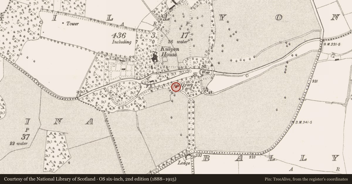
The record
- Townland
- Killyon
- County
- Meath
- Country
- Ireland
- First-edition OS map
- Indicated
- Latest-edition OS map
- Indicated
- Coordinates
- 53.48751, -6.97111
- SMR number
- ME041-006----
Slide toward Today to fade the historical sheet and see the modern map underneath.
David Rumsey Map Collection, Stanford LibrariesDavid Rumsey Map Collection, Stanford LibrariesDavid Rumsey Map Collection, Stanford LibrariesDavid Rumsey Map Collection, Stanford Libraries
4 historical maps cover this location, the earliest the 1790 map "Composite: Ireland." (David Rumsey Map Collection, Stanford Libraries).
Historical maps covering this location
- 1790 · Composite: Ireland. (David Rumsey Map Collection, Stanford Libraries)
- 1799 · Ireland. (David Rumsey Map Collection, Stanford Libraries)
- 1869 · Ireland. (David Rumsey Map Collection, Stanford Libraries)
- 1891 · Ireland 16 (David Rumsey Map Collection, Stanford Libraries)
This record in the National Monuments Service's Historic Environment Viewer ↗
The National Monuments Service's description
Situated at the bottom of a N-facing slope with the W-E River Deel c. 35m to the N. A church at Killyon is listed in the ecclesiastical taxation (1302-06) of Pope Nicholas IV (Cal. doc. Ire., 5, 257). Ussher describes the church and chancel of Killian as ruinous (Erlington 1847-64, xcix). According to Dopping (1683-5) only the church walls were standing and it was not enclosed (Ellison 1973, 10). The parish church of Killyon is within a subrectangular graveyard (dims c. 40m N-S; c. 35m E-W) that has only modern boundaries of wooden and wire fences. The graveyard has headstones dating from 1757 to 1977.
Only the E wall (T 0.95m) and parts of N (int. L 7.4m) and S (int. L 6.2m) walls survive to any extent (max. H 2.5m) of a single cell structure (int. dims 8.35m plus E-W; 5m N-S) that has a destroyed window embrasure (Wth 1.34m) in the E wall and another (Wth 1.43m) in the N wall. A headstone in the church erected in 1787 commemorates seven members of the 18th century Dominican friary at Donore (ME041-007----) c. 2km to the ENE, who are buried here, the earliest date being 1737 (Cogan 1862-70, 1, 309). The holy well (ME041-006002-) is c. 20m to the E.
The above description is derived from the published 'Archaeological Inventory of County Meath' (Dublin: Stationery Office, 1987). In certain instances the entries have been revised and updated in the light of recent research.
Compiled by: Michael Moore
Date of upload: 20 March, 2015
References
Erlington, C. R. (ed.) 1847-64 The whole works of the most Reverend James Ussher. 17 vols. Hodges and Smith, Dublin
Fenning, Rev. H. 1963 The Dominicans of Trim, 1713-1833. Ríocht na Mídhe, 3, 1, 21-32.
Cal. doc. Ire. - Calendar of documents relating to Ireland 1171-1307, ed. H.S. Sweetman (5 vols., London, 1875-86).
Ellison, Rev. C. C. 1971-5 Bishop Dopping's Visitation Book 1682-5, Ríocht na Mídhe, 5, 1, 28-39; 5, 2, 3-13; 5, 3, 3-11; 5, 4, 98-103; 6, 1, 3-13.
Cogan, Rev. A. 1862-70 Ecclesiastical history of the diocese of Meath: ancient and modern. (3 vols) Dublin: John Fowler, Joseph Dollard
Nearby in the register
- Graveyardunder 1 mi
- Ritual site - holy wellunder 1 mi
- Burial groundunder 1 mi
- Enclosureunder 1 mi
Other entries of the same register within about three miles of this one, by straight line.