Sites and Monuments Record · Ireland
Metalworking site
Cooksland, County Meath, Ireland
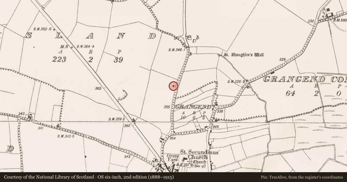
The record
- Townland
- Cooksland
- County
- Meath
- Country
- Ireland
- First-edition OS map
- Not indicated
- Latest-edition OS map
- Not indicated
- Coordinates
- 53.51766, -6.54035
- SMR number
- ME038-082----
Slide toward Today to fade the historical sheet and see the modern map underneath.
David Rumsey Map Collection, Stanford LibrariesDavid Rumsey Map Collection, Stanford LibrariesDavid Rumsey Map Collection, Stanford LibrariesDavid Rumsey Map Collection, Stanford Libraries
4 historical maps cover this location, the earliest the 1799 map "Ireland." (David Rumsey Map Collection, Stanford Libraries).
Historical maps covering this location
- 1799 · Ireland. (David Rumsey Map Collection, Stanford Libraries)
- 1811 · Ireland. (David Rumsey Map Collection, Stanford Libraries)
- 1830 · V.3:11-15:XV. Britisches Reich. C. Kon: Ireland. a. Prov: Leinster. Counties: 1-12 (David Rumsey Map Collection, Stanford Libraries)
- 1891 · Ireland 16 (David Rumsey Map Collection, Stanford Libraries)
This record in the National Monuments Service's Historic Environment Viewer ↗
The National Monuments Service's description
Situated on a slight N-facing slope. Archaeological testing (04E0146) by A. Hayden in advance of a housing development identified a curving trench and some pits that were fully excavated under the same licence (excavations.ie 2004: 1234). The trench (L 8m; max. Wth 1.5m; max. D 0.18m), filled with silty loam, curves around the N side of a pit (diam. 1.2m; D 0.1m) that was filled with charcoal-rich silt and had fragments of iron slag together with a furnace bottom. A small pit (diam. c. 0.5m) filled with charcoal-rich silt was inserted in the curving trench and there was a post-hole at the W end of the trench. Five possible post-holes were c. 2-3m S of the pit and these could have provided a shelter for a small metal-working site, while the trench on the N side provided drainage. (Hayden 2004)
See the attached plan from Hayden (2004, fig. 3)
Compiled by: Michael Moore
Date of upload: 4 May 2022
References
Hayden, A. 2004 Archaeological Assessment and Monitoring at the Navan Road, Dunshaughlin, Co. Meath. Licence: 04E0146. Unpublished report, Archaeological Projects
Nearby in the register
- Excavation - miscellaneousunder 1 mi
- Ritual site - holy wellunder 1 mi
- Metalworking siteunder 1 mi
- Hut siteunder 1 mi
Other entries of the same register within about three miles of this one, by straight line.