Sites and Monuments Record · Ireland
House - 17th century
Knightsbrook, County Meath, Ireland
The record
- Townland
- Knightsbrook
- County
- Meath
- Country
- Ireland
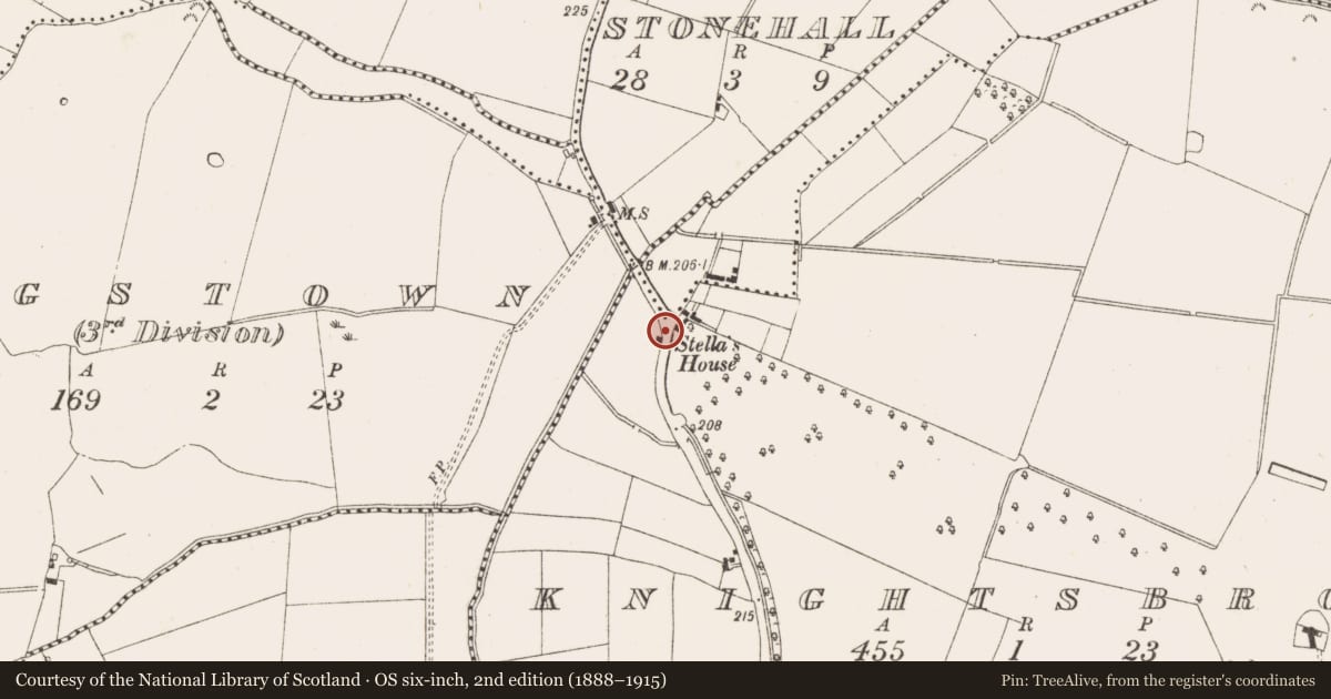
- First-edition OS map
- Stellas House
- Latest-edition OS map
- Stellas House
- Coordinates
- 53.53664, -6.78869
- SMR number
- ME036-078----
Slide toward Today to fade the historical sheet and see the modern map underneath.
David Rumsey Map Collection, Stanford LibrariesDavid Rumsey Map Collection, Stanford LibrariesDavid Rumsey Map Collection, Stanford LibrariesDavid Rumsey Map Collection, Stanford Libraries
4 historical maps cover this location, the earliest the 1790 map "Composite: Ireland." (David Rumsey Map Collection, Stanford Libraries).
Historical maps covering this location
- 1790 · Composite: Ireland. (David Rumsey Map Collection, Stanford Libraries)
- 1799 · Ireland. (David Rumsey Map Collection, Stanford Libraries)
- 1811 · Ireland. (David Rumsey Map Collection, Stanford Libraries)
- 1891 · Ireland 16 (David Rumsey Map Collection, Stanford Libraries)
This record in the National Monuments Service's Historic Environment Viewer ↗
The National Monuments Service's description
Located on a level landscape with a small SW-NE stream c. 70m to the NW. Traditionally, this is the house occupied by Esther Johnson, known as 'Stella' and the life-long friend of Jonathan Swift, when she first came to Ireland in 1701 and wanted to live close to Swift while he was rector of Laracor church (ME036-044----), c. 1.2km to the S. After her death in 1728 the house was occupied by two families and continued to be occupied until c. 1960 when a local committee purchased it. Unfortunately, only the base of the walls could be preserved and built up. It is a rectangular structure (ext. dims 10.1m NW-SE; 6.1m NW-SW; int. dims 9.15m NW-SE; 4.15m NE-SW) with conserved and reconstructed walls (Wth 0.5m; H 1.1m). There is a doorway (Wth 0.9m) in the centre of the NE wall and a recess (Wth 1.35m; D 0.2m) on the SW wall opposite, which might be a fireplace. (Reynolds 1967, 53, fn 19; Haworth 2009, 21-3)
Compiled by: Michael Moore
Date of upload: 20 February, 2015
References
Haworth, R. 2009 Jonathan Swift and the Geography of Laracor. Swift Studies, No. 24, 7-26.
Reynolds, J. 1967 Jonathan Swift – Vicar of Laraor. Ríocht na Mídhe, 4, 1, 41-54.
Nearby in the register
- Ringfort - rathunder 1 mi
- Enclosureunder 1 mi
- Bridgeunder 1 mi
- Ringfort - rathunder 1 mi
Other entries of the same register within about three miles of this one, by straight line.