Sites and Monuments Record · Ireland
Burial
Newtown (Navan Upper By.),Peterstown (Navan Upper By., Newtownclonbun Par.), County Meath, Ireland
The record
- Townland
- Newtown (Navan Upper By.),Peterstown (Navan Upper By., Newtownclonbun Par.)
- County
- Meath
- Country
- Ireland
- First-edition OS map
- Not indicated
- Latest-edition OS map
- Not indicated
- Coordinates
- 53.56118, -6.76933
- SMR number
- ME036-054----
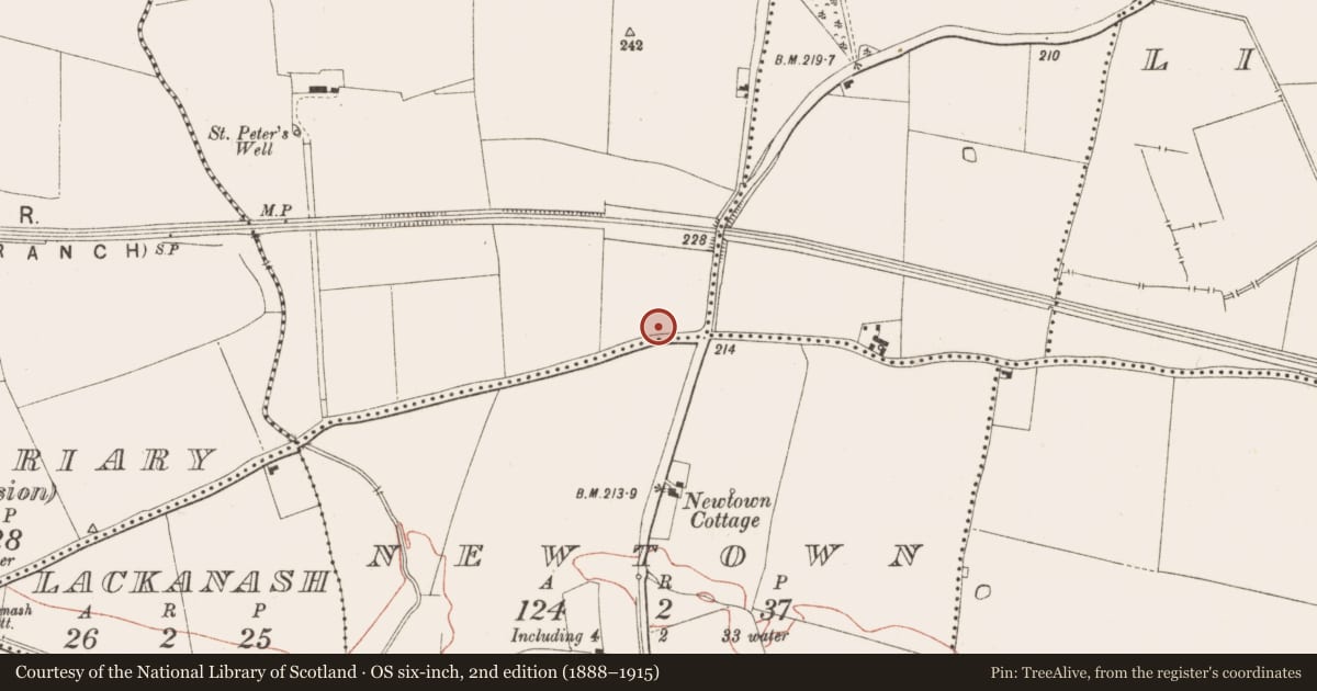
Slide toward Today to fade the historical sheet and see the modern map underneath.
David Rumsey Map Collection, Stanford LibrariesDavid Rumsey Map Collection, Stanford LibrariesDavid Rumsey Map Collection, Stanford LibrariesDavid Rumsey Map Collection, Stanford Libraries
4 historical maps cover this location, the earliest the 1790 map "Composite: Ireland." (David Rumsey Map Collection, Stanford Libraries).
Historical maps covering this location
- 1790 · Composite: Ireland. (David Rumsey Map Collection, Stanford Libraries)
- 1799 · Ireland. (David Rumsey Map Collection, Stanford Libraries)
- 1811 · Ireland. (David Rumsey Map Collection, Stanford Libraries)
- 1891 · Ireland 16 (David Rumsey Map Collection, Stanford Libraries)
This record in the National Monuments Service's Historic Environment Viewer ↗
The National Monuments Service's description
Situated on a slight gravel ridge. Archaeological testing (97E0389) of a road improvement scheme uncovered the inhumed remains of three males and one female aligned W-E. One burial produced a C14 date of 1694 +-37 BP (Cal. AD 414-532). Further testing during 1998 recovered another inhumation 75m to the SE. A single male, aged 17-25, was lying supine W-E in a grave-cut (dis 1.38m E-W; 0.52m N-S; D 0.28-0.36m) c. 1m below present ground level. It produced a C14 date of 446+-46 (Cal. AD 1425-1461) demonstrating that it was unconnected with the earlier burials (Murphy 1998, 2000). Further testing (04E0622) by D. Noonan c. 100m to the NE at the nearest point produced no related material (excavatioins.ie 2004:1352), and testing (18E0631) by I. Russell c. 40m S of the main concentration produced no further inhumations (excavations.ie 2018:721).
Compiled by: Michael Moore
Date of upload: 22 October, 2018
Amended: 29 January 2021, 29 April 2021
References
Murphy, D. 1998 Peterstown, Trim: Early Christian/medieval cemetery. In I. Bennett (ed.) Excavations 1997: summary accounts of archaeological excavations in Ireland, P 143, No. 431. Bray, Wordwell
Murphy, D. 2000 Peterstown, Trim: Possible Early Christian cemetery. In I. Bennett (ed.) Excavations 1998: summary accounts of archaeological excavations in Ireland, P 169, No. 531. Bray, Wordwell
Nearby in the register
- Cross-slab (present location)under 1 mi
- Cross-slab (present location)under 1 mi
- Cross - High cross (present location)under 1 mi
- Cross - High cross (present location)under 1 mi
Other entries of the same register within about three miles of this one, by straight line.