Sites and Monuments Record · Ireland
Font
Collierstown (Skreen By.), County Meath, Ireland
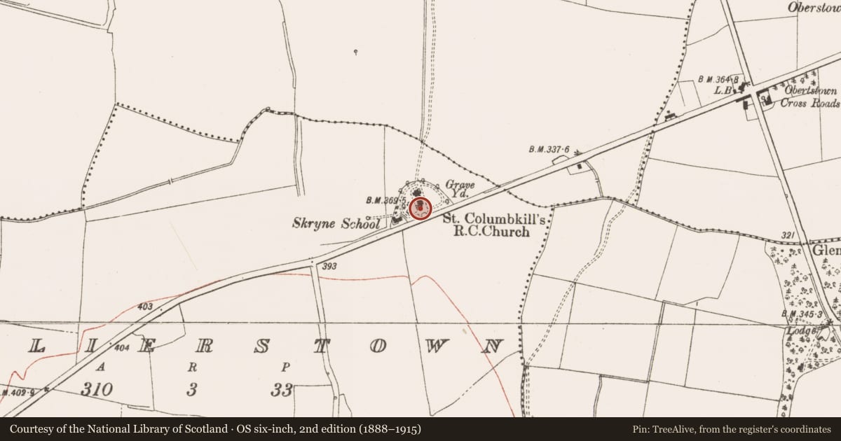
The record
- Townland
- Collierstown (Skreen By.)
- County
- Meath
- Country
- Ireland
- First-edition OS map
- Not indicated
- Latest-edition OS map
- Not indicated
- Coordinates
- 53.57568, -6.55681
- SMR number
- ME032-040004-
Slide toward Today to fade the historical sheet and see the modern map underneath.
David Rumsey Map Collection, Stanford LibrariesDavid Rumsey Map Collection, Stanford LibrariesDavid Rumsey Map Collection, Stanford LibrariesDavid Rumsey Map Collection, Stanford Libraries
4 historical maps cover this location, the earliest the 1799 map "Ireland." (David Rumsey Map Collection, Stanford Libraries).
Historical maps covering this location
- 1799 · Ireland. (David Rumsey Map Collection, Stanford Libraries)
- 1811 · Ireland. (David Rumsey Map Collection, Stanford Libraries)
- 1830 · V.3:11-15:XV. Britisches Reich. C. Kon: Ireland. a. Prov: Leinster. Counties: 1-12 (David Rumsey Map Collection, Stanford Libraries)
- 1891 · Ireland 16 (David Rumsey Map Collection, Stanford Libraries)
This record in the National Monuments Service's Historic Environment Viewer ↗
The National Monuments Service's description
The Roman Catholic church of Skreen was built in 1827 according to a stone in its tower. Built into the inner faces of the walls of the porch are two medieval fonts that are used as stoups. These were probably taken from unknown medieval church sites in the vicinity. That on the E side is an eight-sided limestone (ext. dim. 0.65m) polished from wear with a circular basin (int. diam. 0.48m; D 0.22m) which has pock-marked inner surfaces. Its under-panels are hidden in masonry.
Compiled by: Michael Moore
Date of upload: 28 January, 2015
Nearby in the register
- Fontunder 1 mi
- Cross - Wayside cross (present location)under 1 mi
- Barrow - unclassifiedunder 1 mi
- Enclosureunder 1 mi
Other entries of the same register within about three miles of this one, by straight line.