Sites and Monuments Record · Ireland
Graveyard
Staffordstown (Skreen By.), County Meath, Ireland
The record
- Townland
- Staffordstown (Skreen By.)
- County
- Meath
- Country
- Ireland
- First-edition OS map
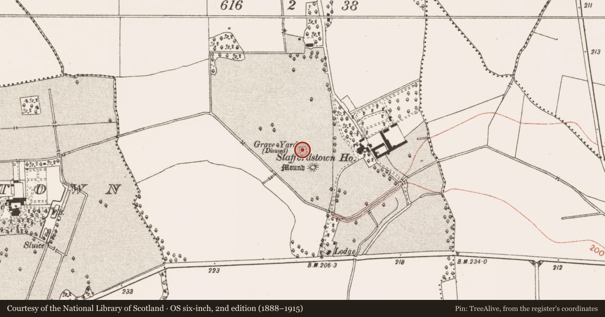
- Grave Yard
- Latest-edition OS map
- Grave Yard (Site of)
- Coordinates
- 53.62776, -6.57809
- SMR number
- ME032-001001-
Slide toward Today to fade the historical sheet and see the modern map underneath.
David Rumsey Map Collection, Stanford LibrariesDavid Rumsey Map Collection, Stanford LibrariesDavid Rumsey Map Collection, Stanford LibrariesDavid Rumsey Map Collection, Stanford Libraries
4 historical maps cover this location, the earliest the 1790 map "Composite: Ireland." (David Rumsey Map Collection, Stanford Libraries).
Historical maps covering this location
- 1790 · Composite: Ireland. (David Rumsey Map Collection, Stanford Libraries)
- 1799 · Ireland. (David Rumsey Map Collection, Stanford Libraries)
- 1830 · V.3:11-15:XV. Britisches Reich. C. Kon: Ireland. a. Prov: Leinster. Counties: 1-12 (David Rumsey Map Collection, Stanford Libraries)
- 1891 · Ireland 16 (David Rumsey Map Collection, Stanford Libraries)
This record in the National Monuments Service's Historic Environment Viewer ↗
The National Monuments Service's description
The site of the parish church of Staffordstown (ME032-001----) is on a shelf at the bottom of a gentle S-facing slope and probably within a rectangular grass-covered graveyard (dims c. 22m N-S; c. 20m E-W), although there is no physical evidence of it. The enclosure is defined by earthen banks (Wth 2-3m; int. H 0.2m; ext. H 0.5-0.8m) and outer fosses (Wth of top c. 2-3m; ext. D 0.2-0.4m) on three sides, and a slight scarp at S. A small rectangular area defined by stone-facings and filled with stones at the NW angle of the enclosure may be a mausoleum (ME032-001004-). Apart from this there is no other evidence of burial in the enclosure, although it is described as a graveyard on the 1836 and 1909 eds of the OS 6-inch map. The font (ME032-001002-) from here was moved c. 1975 to the Roman Catholic church in Walterstown (ME032-077----), c. 2.5km to the SE, and the armorial plaque (ME032-001003-) from the Cussack monument in Trevet graveyard (ME038-017002-) that was here (Hickey 1971, 77-8) is now missing.
Compiled by: Michael Moore
Date of upload: 22 January, 2015
References
Hickey, E. 1971 Monument to Sir Thomas Cusack. Ríocht na Mídhe, 4, 5, 75-91.
Nearby in the register
- Churchunder 1 mi
- Fontunder 1 mi
- Armorial plaqueunder 1 mi
- Mausoleumunder 1 mi
Other entries of the same register within about three miles of this one, by straight line.