Sites and Monuments Record · Ireland
Excavation - miscellaneous
Town Parks (Lune By.), County Meath, Ireland
The record
- Townland
- Town Parks (Lune By.)
- County
- Meath
- Country
- Ireland
- Coordinates
- 53.62093, -6.91992
- SMR number
- ME029-023011-
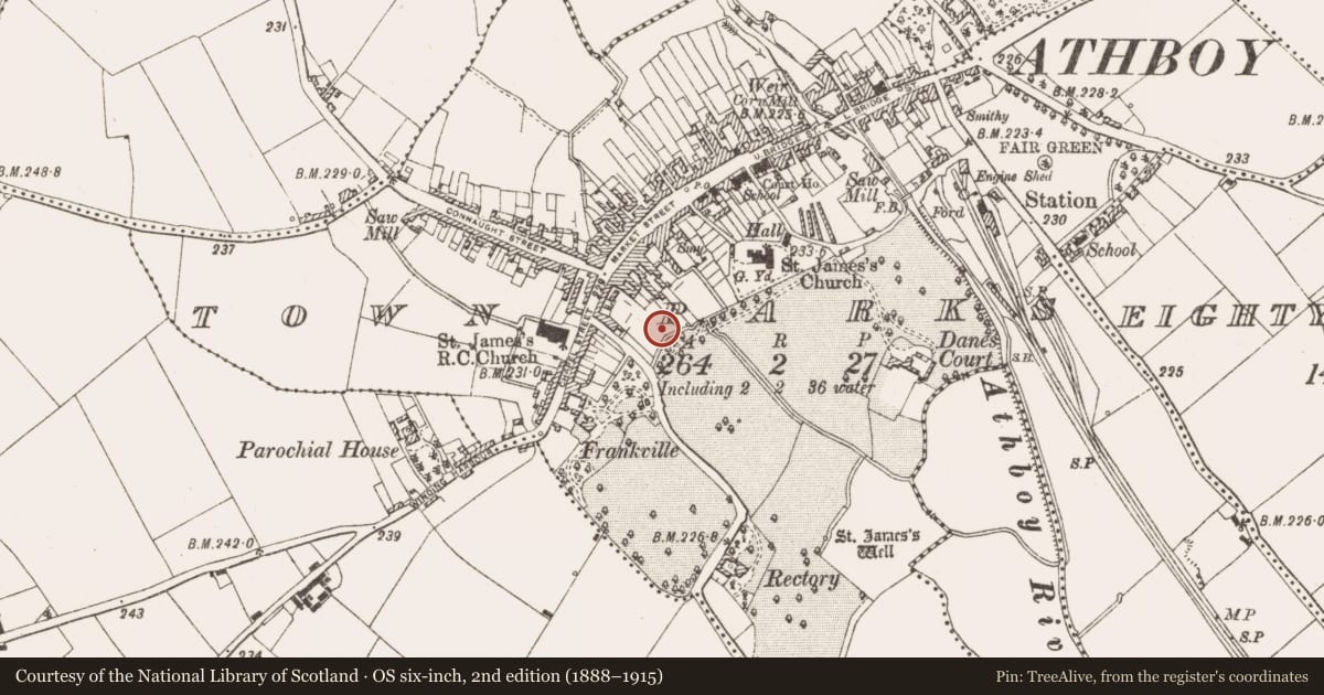
Slide toward Today to fade the historical sheet and see the modern map underneath.
David Rumsey Map Collection, Stanford LibrariesDavid Rumsey Map Collection, Stanford LibrariesDavid Rumsey Map Collection, Stanford LibrariesDavid Rumsey Map Collection, Stanford Libraries
4 historical maps cover this location, the earliest the 1790 map "Composite: Ireland." (David Rumsey Map Collection, Stanford Libraries).
Historical maps covering this location
- 1790 · Composite: Ireland. (David Rumsey Map Collection, Stanford Libraries)
- 1799 · Ireland. (David Rumsey Map Collection, Stanford Libraries)
- 1869 · Ireland. (David Rumsey Map Collection, Stanford Libraries)
- 1891 · Ireland 16 (David Rumsey Map Collection, Stanford Libraries)
This record in the National Monuments Service's Historic Environment Viewer ↗
The National Monuments Service's description
Excavation (01E0883) within the town wall of Athboy has produced some evidence of medieval occupation in six intercutting medieval and post-medieval pits (max. diam. 4m; max. D 1.3m) inside the robber trench (Wth of top 1.45-2.2.5m; D 0.9-1.5m) on the WNW-ESE line of the town wall (L 50m plus). The robbed wall would have cut across the burgage plots depicted on the 1836 edition of the OS 6-inch map. (Danaher 2001; 2003; O’Hara 2002; 2004)
Compiled by: Michael Moore
Date of upload: 28 February 2019
References
O'Hara, R. 2004 Townparks, Athboy: urban medieval. In I. Bennett (ed.) Excavations 2002: summary accounts of archaeological excavations in Ireland, No. 1419, 401-03. Bray, Wordwell
O'Hara, R. 2002 Archaeological Testing Athboy, Co. Meath. Licence No. 01E0883 ext. Unpublished excavation, Archaeological Consultancy Services
Danaher, E. 2003 Townparks, Athboy: urban. In I. Bennett (ed.) Excavations 2001: summary accounts of archaeological excavations in Ireland, No. 935, 285. Bray, Wordwell
Danaher, E. 2001 Archaeological excavation at Townparks, Athboy, Co. Meath. Licence No. 01E0883 ext. Unpublished excavation, Archaeological Consultancy Services
Nearby in the register
- Buildingunder 1 mi
- Town defencesunder 1 mi
- Road - road/trackwayunder 1 mi
- Graveslabunder 1 mi
Other entries of the same register within about three miles of this one, by straight line.