Sites and Monuments Record · Ireland
Graveslab
Moorechurch, County Meath, Ireland
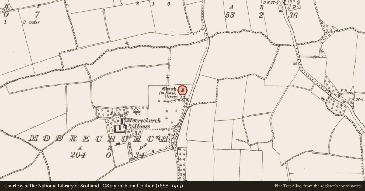
The record
- Townland
- Moorechurch
- County
- Meath
- Country
- Ireland
- First-edition OS map
- Not indicated
- Latest-edition OS map
- Not indicated
- Coordinates
- 53.66075, -6.27935
- SMR number
- ME028-010003-
Slide toward Today to fade the historical sheet and see the modern map underneath.
David Rumsey Map Collection, Stanford LibrariesDavid Rumsey Map Collection, Stanford LibrariesDavid Rumsey Map Collection, Stanford LibrariesDavid Rumsey Map Collection, Stanford Libraries
4 historical maps cover this location, the earliest the 1799 map "Ireland." (David Rumsey Map Collection, Stanford Libraries).
Historical maps covering this location
- 1799 · Ireland. (David Rumsey Map Collection, Stanford Libraries)
- 1811 · Ireland. (David Rumsey Map Collection, Stanford Libraries)
- 1841 · Ireland. (David Rumsey Map Collection, Stanford Libraries)
- 1891 · Ireland 16 (David Rumsey Map Collection, Stanford Libraries)
This record in the National Monuments Service's Historic Environment Viewer ↗
The National Monuments Service's description
A graveslab of Thomas Buckley dated 1617 that was in the chancel of Moorchurch parish church (ME028-010----) cannot be identified. It is described (Dix 1898-1900, 461) as being in two pieces and having a figure of a man in 'Elizabethan costume' at the centre and a fragmentary inscription around three sides that reads: HERE LIETH THE BODIE OF / THOMAS BUCKELY, GENT, WHO DI-- / --OCTOBER, 1617.
Compiled by: Michael Moore
Date of upload: 23 December, 2014
References
Dix, E. R. 1899-1900 Moorechurch Parish. Journal of the Association for the Preservation of the Memorials of the Dead, Ireland. 4 460-2.
Nearby in the register
- Wall monumentunder 1 mi
- Churchunder 1 mi
- Graveyardunder 1 mi
- Ring-ditchunder 1 mi
Other entries of the same register within about three miles of this one, by straight line.