Sites and Monuments Record · Ireland
Burnt mound
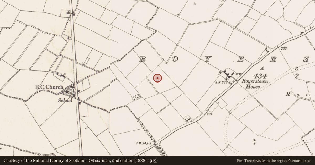
Boyerstown, County Meath, Ireland
The record
- Townland
- Boyerstown
- County
- Meath
- Country
- Ireland
- First-edition OS map
- Not indicated
- Latest-edition OS map
- Not indicated
- Coordinates
- 53.63573, -6.74412
- SMR number
- ME025-091----
Slide toward Today to fade the historical sheet and see the modern map underneath.
David Rumsey Map Collection, Stanford LibrariesDavid Rumsey Map Collection, Stanford LibrariesDavid Rumsey Map Collection, Stanford LibrariesDavid Rumsey Map Collection, Stanford Libraries
4 historical maps cover this location, the earliest the 1790 map "Composite: Ireland." (David Rumsey Map Collection, Stanford Libraries).
Historical maps covering this location
- 1790 · Composite: Ireland. (David Rumsey Map Collection, Stanford Libraries)
- 1799 · Ireland. (David Rumsey Map Collection, Stanford Libraries)
- 1811 · Ireland. (David Rumsey Map Collection, Stanford Libraries)
- 1891 · Ireland 16 (David Rumsey Map Collection, Stanford Libraries)
This record in the National Monuments Service's Historic Environment Viewer ↗
The National Monuments Service's description
Archaeological testing (04E0581) by N. Fairburn of Testing Area 8 of Contract 3 in advance of the M3 motorway identified two potential monuments, Boyerstown 6 and 7 (excavations.ie 2004:1157). No 7 was a burnt mound that was fully resolved (E003112) by L. Clarke (2008, 2-3) in August 2006 (excavations.ie 2006:1521) when it proved to be a cut (dims 8m x 3.8m; D 0.7m) in the subsoil that was filled with a spread of burnt mound material (dims 4.2m x 2.4m; T 0.7m). This was partly overlain by a layer of brown/grey clay with occasional inclusions of charcoal and burnt stone (diam. 3.6-3.7m; T 0.5m). A sample of ash charcoal from this provided the C14 date 2287-2035 Cal. BC (BETA 241321). Three pits (dims 1.7m x 1.3m; D 0.12m: dims 1.35m x 0.23m; D 0.11m: diam. 0.65-0.68m; D 0.15m) in the vicinity, none of which could be described as troughs, were filled with silty clays with some burnt stone. There were also two post-holes and a short channel (L 4.5m; Wth 0.6m; D 0.08m). No artefacts were recovered. (Clarke 2008)
Compiled by: Michael Moore
Date of upload: 12 April, 2023
Clarke, L. 2008 M3 Clonee-North of Kells. Contract 3 – Navan Bypass. Report on the Archaeological Excavation of Boyerstown 7, Co. Meath. Licence: E003112. Final Unpublished report, Archaeological Consultancy Services
Nearby in the register
- Pitunder 1 mi
- Enclosureunder 1 mi
- Kiln - corn-dryingunder 1 mi
- Fulacht fiaunder 1 mi
Other entries of the same register within about three miles of this one, by straight line.