Sites and Monuments Record · Ireland
Structure
Moathill, County Meath, Ireland
The record
- Townland
- Moathill
- County
- Meath
- Country
- Ireland
- First-edition OS map
- Not indicated
- Latest-edition OS map
- Not indicated
- Coordinates
- 53.65288, -6.70051
- SMR number
- ME025-081003-
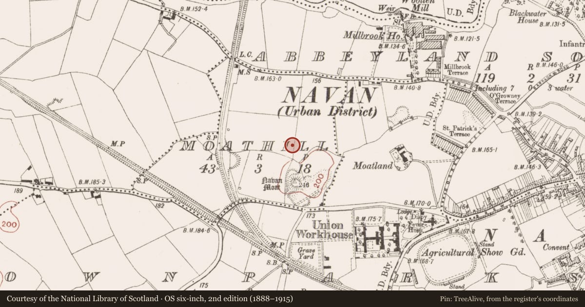
Slide toward Today to fade the historical sheet and see the modern map underneath.
David Rumsey Map Collection, Stanford LibrariesDavid Rumsey Map Collection, Stanford LibrariesDavid Rumsey Map Collection, Stanford LibrariesDavid Rumsey Map Collection, Stanford Libraries
4 historical maps cover this location, the earliest the 1790 map "Composite: Ireland." (David Rumsey Map Collection, Stanford Libraries).
Historical maps covering this location
- 1790 · Composite: Ireland. (David Rumsey Map Collection, Stanford Libraries)
- 1799 · Ireland. (David Rumsey Map Collection, Stanford Libraries)
- 1811 · Ireland. (David Rumsey Map Collection, Stanford Libraries)
- 1891 · Ireland 16 (David Rumsey Map Collection, Stanford Libraries)
This record in the National Monuments Service's Historic Environment Viewer ↗
The National Monuments Service's description
Two structures were E of the major NNE-SSW boundary ditch (ME025-081----). An arc of a slot-trench N-E is centred on a large post-hole and the scarp of the inner edge of a slot-trench can also be traced at S (diam. c. 5m). If this was a small hut site it either pre- or post-dates another feature just to the E. The E structure has a large pit (dim. 1.3m plus; D 0.06m) at the centre with a lightly burnt base that could be a charcoal-making pit as it was filled with charcoal. A S-N trench (L 2.7m plus; Wth 0.6m; D 0.45m) extends S from the pit but the junction lay outside the excavated area. The combined pit and trench are enclosed by 16 post-holes maintaining a regular distances of c. 1-2m from them constituting the possible Structure 5. (Giacometti 2007, P 47-50)
See the attached plans:_02 of excavated features (from Halliday 2009 fig. 25); _03 Rectangular enclosure and ring-ditches (_04) from Giacometti (2007 figs 6, 10)
Compiled by: Michael Moore
Date of upload: 5 April, 2023
Giacometti, A. 2007 Site 1. Navan Inner Relief Road. Licence: 06E0274. Final unpublished report, Arch-Tech
Nearby in the register
- Enclosureunder 1 mi
- Ring-ditchunder 1 mi
- Metalworking siteunder 1 mi
- Field boundaryunder 1 mi
Other entries of the same register within about three miles of this one, by straight line.