Sites and Monuments Record · Ireland
Barrow - unclassified
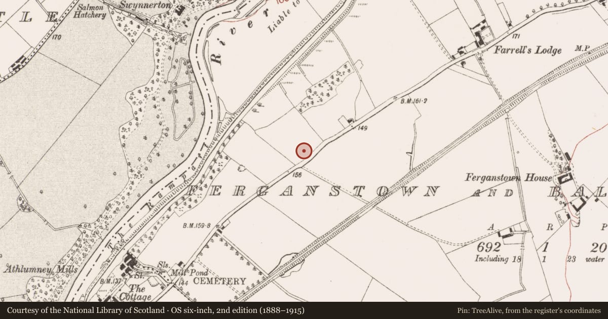
Ferganstown And Ballymacon, County Meath, Ireland
The record
- Townland
- Ferganstown And Ballymacon
- County
- Meath
- Country
- Ireland
- First-edition OS map
- Not indicated
- Latest-edition OS map
- Not indicated
- Coordinates
- 53.66159, -6.65761
- SMR number
- ME025-029----
Slide toward Today to fade the historical sheet and see the modern map underneath.
David Rumsey Map Collection, Stanford LibrariesDavid Rumsey Map Collection, Stanford LibrariesDavid Rumsey Map Collection, Stanford LibrariesDavid Rumsey Map Collection, Stanford Libraries
4 historical maps cover this location, the earliest the 1790 map "Composite: Ireland." (David Rumsey Map Collection, Stanford Libraries).
Historical maps covering this location
- 1790 · Composite: Ireland. (David Rumsey Map Collection, Stanford Libraries)
- 1799 · Ireland. (David Rumsey Map Collection, Stanford Libraries)
- 1811 · Ireland. (David Rumsey Map Collection, Stanford Libraries)
- 1891 · Ireland 16 (David Rumsey Map Collection, Stanford Libraries)
This record in the National Monuments Service's Historic Environment Viewer ↗
The National Monuments Service's description
Located at the crest of a N-facing slope overlooking a SSW-NNE portion of the River Boyne and its flood-plain which begins to expand here on the E bank. An inhumation in a long cist or slab-lined grave was uncovered at the centre of what was described locally as a circular mound (diam. c. 14m; H c. 1m) that was destroyed during building work in 1976. The supine burial of a female was extended E-W with the head at W and it was recorded by E. P. Kelly of the National Museum of Ireland (excavations.ie 1976:028). No artefacts were recovered, although human bones were retrieved from the spoil. No close date is available but it is likely to be an Iron Age pre-Christian interment (Kelly 1977) and it may well be the location referred to by Wilde (1849, 163) as Knock-a-Raymon (ME025-028----). Archaeological monitoring (99E0011) by C. Mullins of a sewage trench on the road to the S produced no related material (excavatrions.ie 1999:686) and further monitoring (06E0165) by S. Delaney of the laying of a water-pipe in the same area produced had a similar result (excavationis.ie 2006:1606).
The above description is derived from the published 'Archaeological Inventory of County Meath' (Dublin: Stationery Office, 1987). In certain instances the entries have been revised and updated in the light of recent research.
Compiled by: Michael Moore
Date of upload: 10 July 2007
Revised: 29 March 2023
Kelly, E. P. 1977 A burial at Ferganstown and Ballymacon, Co. Meath. Riocht na Midhe vol. 6, No. 3, 65-7
Nearby in the register
- Enclosureunder 1 mi
- Cistunder 1 mi
- Souterrainunder 1 mi
- Hut siteunder 1 mi
Other entries of the same register within about three miles of this one, by straight line.